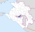
File:Krasnodarsky Krai-admin.png

Size of this preview: 640 × 600 pixels. Other resolutions: 256 × 240 pixels | 820 × 768 pixels | 1,093 × 1,024 pixels | 2,185 × 2,048 pixels | 3,578 × 3,353 pixels.
Original file (3,578 × 3,353 pixels, file size: 399 KB, MIME type: image/png)
File information
Structured data
Captions
Captions
Add a one-line explanation of what this file represents
أتشويفو
Summary edit
| DescriptionKrasnodarsky Krai-admin.png |
см. выше English: Administrative map of Krasnodarsky krai (Russia) in Mercator projecton cropped by 1 degree lines (36° - 42° E, 43° - 47° N).
Русский: Административная карта Краснодарского края и Адыгеи в проекции Меркатора, обрезанная ровно по градусной сетке (36° - 42° в.д., 43° - 47° с.ш.).
Українська: Адміністративна карта Краснодарського краю (Кубань) та Адигеї в проекції Меркатора, обрізана по градусним лініям (36° - 42° с.д., 43° - 47° п.ш.). |
| Date | 20 March 2007 (upload date) |
| Source | Own work |
| Author | Koryakov Yuri |
| Other versions |
Derivative works of this file: Krasnodarsky Krai-admin with numbers.png:  |
Licensing edit
| Public domainPublic domainfalsefalse |
| I, the copyright holder of this work, release this work into the public domain. This applies worldwide. In some countries this may not be legally possible; if so: I grant anyone the right to use this work for any purpose, without any conditions, unless such conditions are required by law. |
File history
Click on a date/time to view the file as it appeared at that time.
| Date/Time | Thumbnail | Dimensions | User | Comment | |
|---|---|---|---|---|---|
| current | 12:38, 23 September 2012 |  | 3,578 × 3,353 (399 KB) | Mapmaster (talk | contribs) | Republik Adygeja herausgehoben |
| 17:14, 30 July 2012 |  | 3,578 × 3,353 (92 KB) | Ras67 (talk | contribs) | cropped, opt. | |
| 21:24, 20 March 2007 |  | 3,610 × 3,385 (123 KB) | Koryakov Yuri (talk | contribs) | Administrative map of Krasnodarsky krai (Russia) in Mercator projecton cropped by 1 degree lines (36 - 42 E, 43 - 47 N). |
You cannot overwrite this file.
File usage on Commons
The following 3 pages use this file:
File usage on other wikis
The following other wikis use this file:
- Usage on ar.wikipedia.org
- Usage on arz.wikipedia.org
- Usage on de.wikipedia.org
- Usage on diq.wikipedia.org
- Usage on el.wikipedia.org
- Usage on fa.wikipedia.org
- Usage on hr.wikipedia.org
- Usage on id.wikipedia.org
- Usage on jv.wikipedia.org
- Usage on mr.wikipedia.org
- Usage on nn.wikipedia.org
- Mal:Kartposisjon Krasnodar kraj
- Krasnodar
- Sotsji
- Novorossijsk
- Armavir i Russland
- Kropotkin i Krasnodar kraj
- Tikhoretsk
- Tuapse
- Slavjansk-na-Kubani
- Krymsk
- Beloretsjensk
- Anapa
- Gelendzjik
- Apsjeronsk
- Gorjatsjij Kljutsj
- Gulkevitsji
- Khadyzjensk
- Korenovsk
- Kurganinsk
- Novokubansk
- Primorsko-Akhtarsk
- Temrjuk
- Ust-Labinsk
- Usage on pl.wikipedia.org
- Usage on ru.wikimedia.org
- Usage on sco.wikipedia.org
View more global usage of this file.
Metadata
This file contains additional information such as Exif metadata which may have been added by the digital camera, scanner, or software program used to create or digitize it. If the file has been modified from its original state, some details such as the timestamp may not fully reflect those of the original file. The timestamp is only as accurate as the clock in the camera, and it may be completely wrong.
| Horizontal resolution | 37.8 dpc |
|---|---|
| Vertical resolution | 37.8 dpc |