File:Kristians amt nr 20-1-1- Kart over Dok med Sinnersli; Snæresli og Espedalen, 1879.jpg
Size of this preview: 630 × 599 pixels. Other resolutions: 252 × 240 pixels | 505 × 480 pixels | 807 × 768 pixels | 1,077 × 1,024 pixels | 2,153 × 2,048 pixels | 6,719 × 6,391 pixels.
Original file (6,719 × 6,391 pixels, file size: 6.42 MB, MIME type: image/jpeg)
Captions
Captions
Add a one-line explanation of what this file represents
Summary edit
| Title |
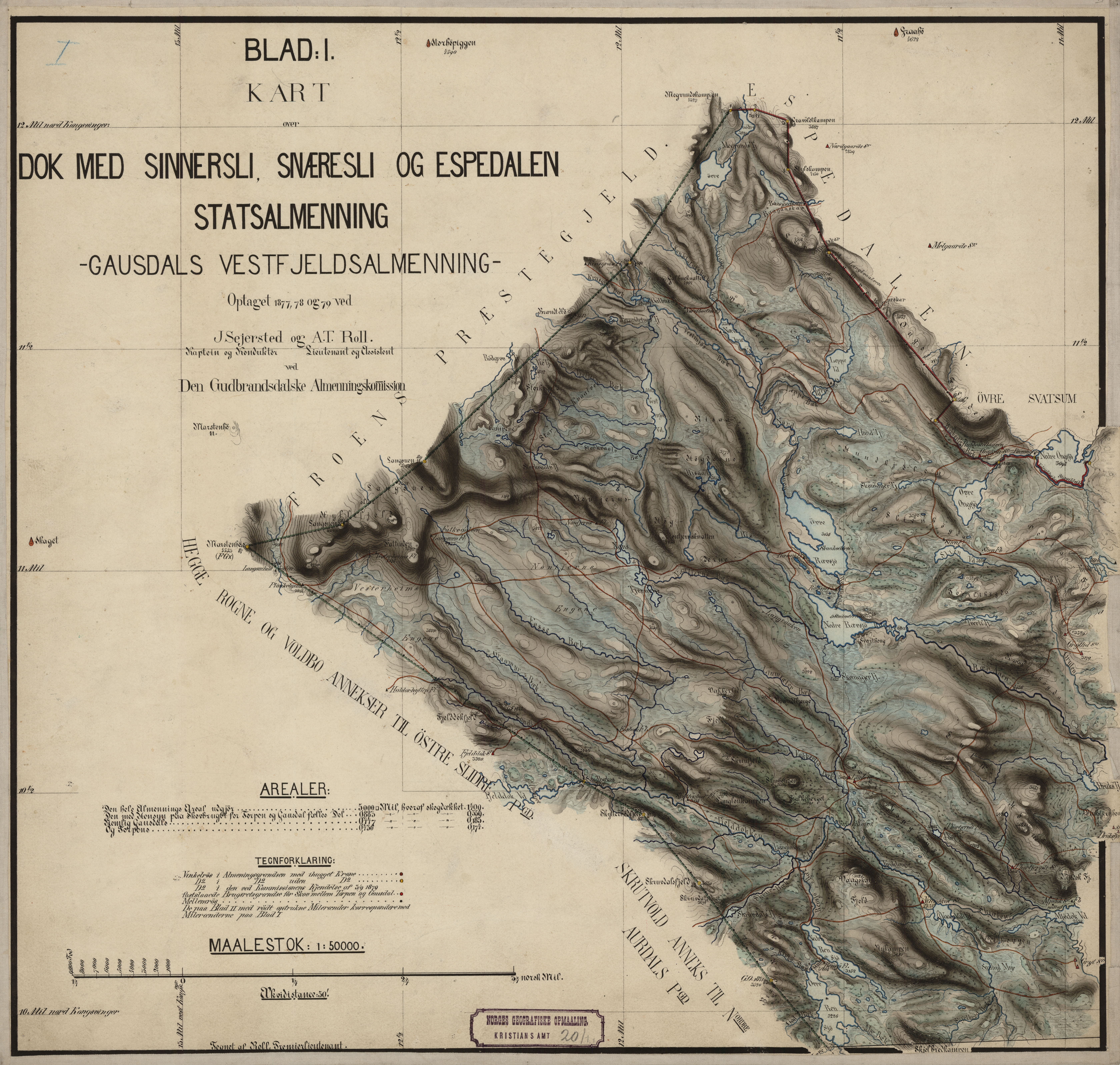
Norsk bokmål: Kristians amt nr 20-1-1: Kart over Dok med Sinnersli; Snæresli og Espedalen, 1879 |
||||||||||||||||||||||||||
| Description |
Norsk bokmål: Kart over Statsalmenningerne i Gudbrandsdalen; optagne for den gudbrandsdalske Almenningskommisjon. Med Oversigtskart. De tilføiede romertal refererer sig til oversigtskarterne. Kart over Dok med Sinnersli; Snæresli og Espedalens Statsalmenning - Gausdals vestfjeldske Almenning (I) |
||||||||||||||||||||||||||
| Date | |||||||||||||||||||||||||||
| Source |
|
||||||||||||||||||||||||||
| Creator |
Seierstad, Roll |
||||||||||||||||||||||||||
| Permission (Reusing this file) |
This file is licensed under the Creative Commons Attribution 4.0 International license.
|
||||||||||||||||||||||||||
| Geotemporal data | |||||||||||||||||||||||||||
| Date depicted | |||||||||||||||||||||||||||
| Map location | Oppland (Oppland,Gausdals vestfjelsalmenning) | ||||||||||||||||||||||||||
| Scale | 1:50,000 | ||||||||||||||||||||||||||
| Georeferencing | If inappropriate please set warp_status = skip to hide. | ||||||||||||||||||||||||||
| Bibliographic data | |||||||||||||||||||||||||||
| Part of the series | Category:Kristian county | ||||||||||||||||||||||||||
| Map sheet | 20.01.2001 | ||||||||||||||||||||||||||
| Language | Norwegian | ||||||||||||||||||||||||||
| Archival data | |||||||||||||||||||||||||||
| Collection |
|
||||||||||||||||||||||||||
| Accession number | |||||||||||||||||||||||||||
| Medium | drawing | ||||||||||||||||||||||||||
File history
Click on a date/time to view the file as it appeared at that time.
| Date/Time | Thumbnail | Dimensions | User | Comment | |
|---|---|---|---|---|---|
| current | 06:34, 31 October 2015 | | 6,719 × 6,391 (6.42 MB) | Artturimatias (talk | contribs) | GWToolset: Creating mediafile for Artturimatias. |
You cannot overwrite this file.
File usage on Commons
There are no pages that use this file.