File:Krumau 1823 detail.jpg

Size of this preview: 800 × 403 pixels. Other resolutions: 320 × 161 pixels | 640 × 322 pixels | 1,024 × 516 pixels | 1,280 × 645 pixels | 2,560 × 1,290 pixels | 4,785 × 2,411 pixels.
Original file (4,785 × 2,411 pixels, file size: 18.46 MB, MIME type: image/jpeg)
Captions
Captions
Add a one-line explanation of what this file represents
Summary
edit| Description |
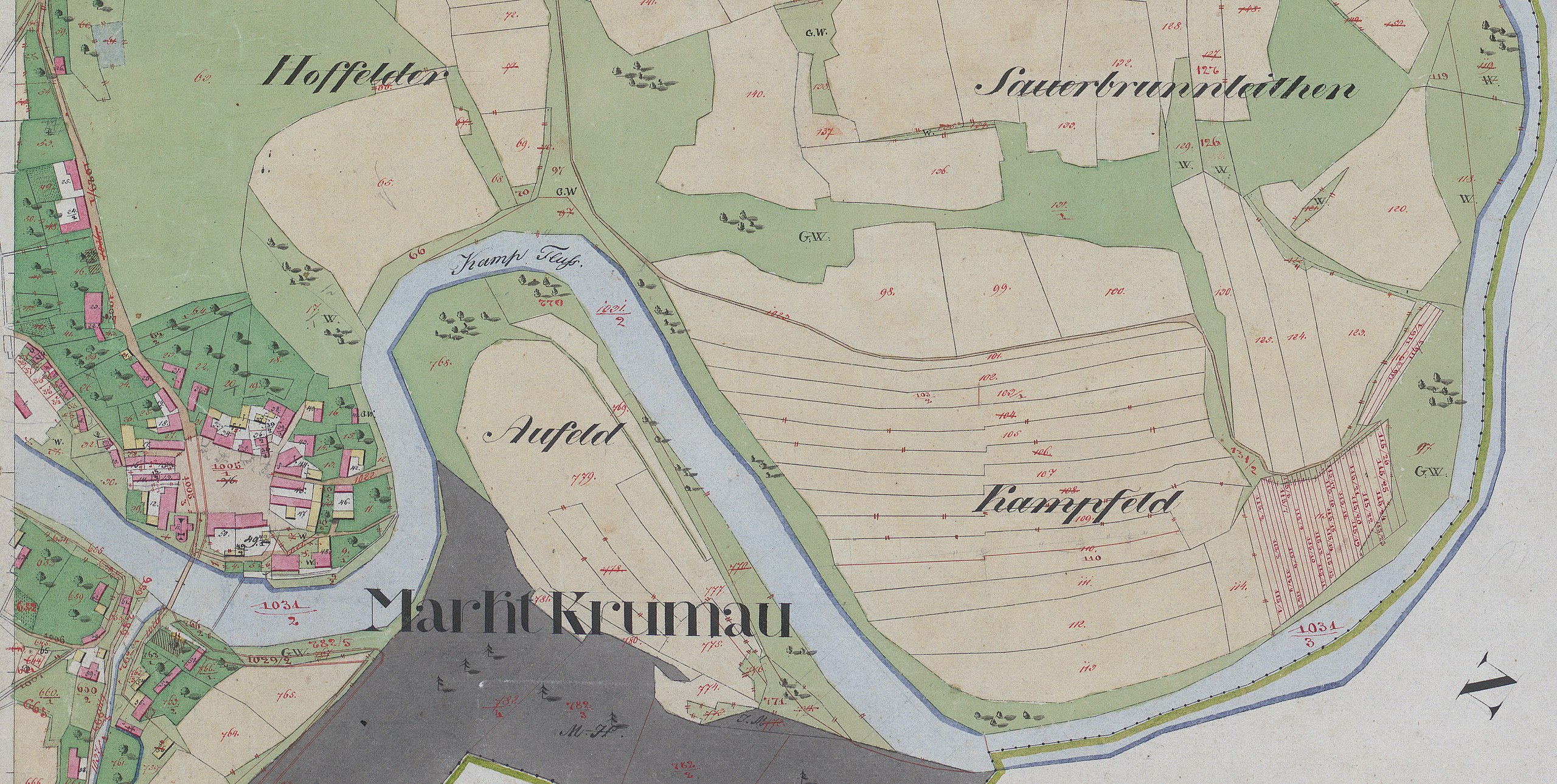
English: historic map from the Second Military Mapping Survey of the Austrian Empire, Krumau am Kamp 1823 |
| Date | |
| Source | Militärgeographisches Institut der österreichisch-ungarischen Monarchie |
| Author | Franziszeische Landesaufnahme |
| Other versions |

Licensing
edit
|
This work is in the public domain in its country of origin and other countries and areas where the copyright term is the author's life plus 70 years or fewer. This work is in the public domain in the United States because it was published (or registered with the U.S. Copyright Office) before January 1, 1929. | |
| This file has been identified as being free of known restrictions under copyright law, including all related and neighboring rights. | |
File history
Click on a date/time to view the file as it appeared at that time.
| Date/Time | Thumbnail | Dimensions | User | Comment | |
|---|---|---|---|---|---|
| current | 12:40, 3 April 2020 | | 4,785 × 2,411 (18.46 MB) | HylgeriaK (talk | contribs) | Uploaded a work by Franziszeische Landesaufnahme from Militärgeographisches Institut der österreichisch-ungarischen Monarchie with UploadWizard |
You cannot overwrite this file.
File usage on Commons
The following page uses this file:
File usage on other wikis
The following other wikis use this file:
- Usage on de.wikipedia.org