File:Kuźnica (gmina) location map.png

Size of this preview: 395 × 599 pixels. Other resolutions: 158 × 240 pixels | 316 × 480 pixels | 650 × 986 pixels.
Original file (650 × 986 pixels, file size: 136 KB, MIME type: image/png)
Captions
Captions
Add a one-line explanation of what this file represents
| Description |
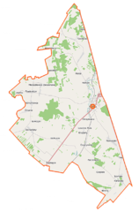
Polski: Mapa gminy Kuźnica, Polska
English: Map of Gmina Kuźnica, Poland |
|||||||||
| Date | ||||||||||
| Source | You may find a page on the OpenStreetMap wiki page for Kuźnica (gmina) | |||||||||
| Creator |
OpenStreetMap contributors OpenStreetMap contributors |
|||||||||
| Permission (Reusing this file) |
OpenStreetMap data is available under the Open Database License (details). Map tiles are licensed under the Creative Commons Attribution-ShareAlike 2.0 license (CC-BY-SA 2.0).
This file is licensed under the Creative Commons Attribution-Share Alike 2.0 Generic license.
|
|||||||||
| Geotemporal data | ||||||||||
| Bounding box |
|
|||||||||
| Georeferencing | If inappropriate please set warp_status = skip to hide. | |||||||||
File history
Click on a date/time to view the file as it appeared at that time.
| Date/Time | Thumbnail | Dimensions | User | Comment | |
|---|---|---|---|---|---|
| current | 10:12, 16 September 2014 | | 650 × 986 (136 KB) | VanWiel (talk | contribs) | {{Information |Description= |Source= |Date= |Author= |Permission= |other_versions= }} |
| 05:16, 26 June 2014 |  | 650 × 986 (184 KB) | VanWiel (talk | contribs) | {{OpenStreetMap | name = Kuźnica (gmina) | location = Kuźnica (gmina) | description = {{pl|Mapa gminy Kuźnica, Polska}} {{en|Map of Gmina Kuźnica, Poland}} | top = 53.6108 | left = 23.4977 | r... |
You cannot overwrite this file.
File usage on Commons
There are no pages that use this file.
File usage on other wikis
The following other wikis use this file:
- Usage on pl.wikipedia.org
- Kuźnica (województwo podlaskie)
- Kuźnica (gmina)
- Achrymowce
- Białobłockie
- Bilminy
- Chreptowce
- Cimanie
- Czepiele
- Czuprynowo
- Długosielce
- Klimówka
- Kruglany
- Kuścińce
- Łosośna Wielka
- Łowczyki
- Mieleszkowce Pawłowickie
- Mieleszkowce Zalesiańskie
- Milenkowce
- Nowodziel
- Parczowce
- Popławce
- Saczkowce
- Starowlany
- Wołkusze
- Wyzgi
- Litwinki (województwo podlaskie)
- Szymaki (województwo podlaskie)
- Kowale (powiat sokólski)
- Tołcze (powiat sokólski)
- Wołyńce (powiat sokólski)
- Wojnowce (gmina Kuźnica)
- Kowale-Kolonia
- Gładowszczyzna
- Zajzdra
- Sterpejki
- Kuścin
- Auls
- Dubnica Kurpiowska
- Kierkielewszczyzna
- Kryski
- Łosośna Mała
- Palestyna (Bilminy)
- Szalciny
- Tołoczki Małe
- Tołoczki Wielkie
- Ułeczki
- Przejście graniczne Kuźnica Białostocka-Grodno
- Kuźnica Białostocka (stacja kolejowa)
- Czuprynowo (przystanek kolejowy)
- Cmentarz żydowski w Kuźnicy Białostockiej
View more global usage of this file.
_location_map.png)
_location_map.png&oldid=519972979)