File:Kuntisuyu and Antisuyu in 1500 in OpenHistoricalMap.png
Size of this preview: 800 × 500 pixels. Other resolutions: 320 × 200 pixels | 640 × 400 pixels | 1,024 × 640 pixels | 1,280 × 800 pixels | 2,880 × 1,800 pixels.
Original file (2,880 × 1,800 pixels, file size: 967 KB, MIME type: image/png)
Captions
Captions
Add a one-line explanation of what this file represents
Summary
edit
| Description |
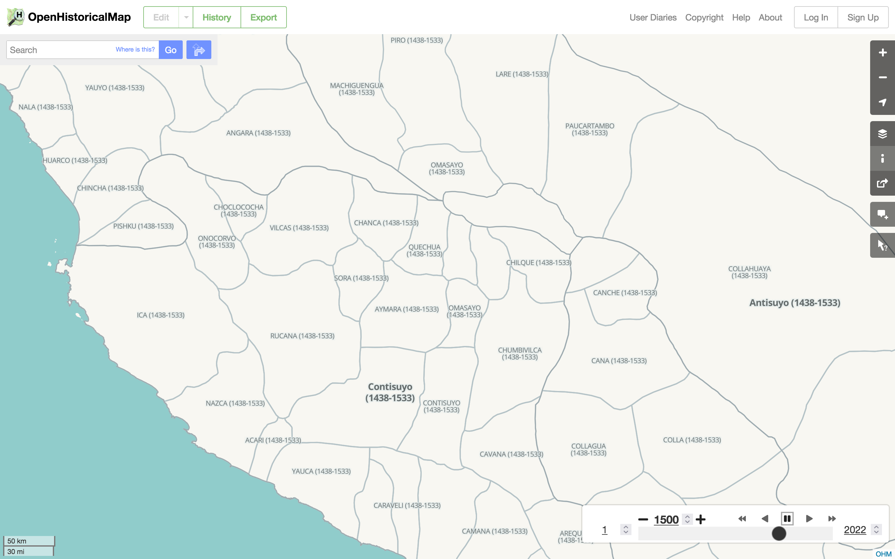
English: A screenshot of OpenHistoricalMap showing the Inca Empire’s Kuntisuyu and Antisuyu regions and their provinces as of 1500. |
| Date | |
| Source | OpenHistoricalMap |
| Author | OpenHistoricalMap contributors |
| Permission (Reusing this file) |
The website and Historical map style themselves are in the public domain through a Creative Commons Zero dedication. Visible map data is derived from Tahuantinsuyo.png and available under the Creative Commons Attribution–ShareAlike 4.0 license. [1] |
| Other versions |
This file was derived from: Tahuantinsuyo.png |
Licensing
edit
This file is licensed under the Creative Commons Attribution-Share Alike 4.0 International license.
- You are free:
- to share – to copy, distribute and transmit the work
- to remix – to adapt the work
- Under the following conditions:
- attribution – You must give appropriate credit, provide a link to the license, and indicate if changes were made. You may do so in any reasonable manner, but not in any way that suggests the licensor endorses you or your use.
- share alike – If you remix, transform, or build upon the material, you must distribute your contributions under the same or compatible license as the original.
File history
Click on a date/time to view the file as it appeared at that time.
| Date/Time | Thumbnail | Dimensions | User | Comment | |
|---|---|---|---|---|---|
| current | 06:22, 22 April 2022 | | 2,880 × 1,800 (967 KB) | Mxn (talk | contribs) | Uploaded a work by OpenHistoricalMap contributors from [https://openhistoricalmap.org/#map=8/-14.352/-72.389&layers=O&date=1500&daterange=1,2022 OpenHistoricalMap] with UploadWizard |
You cannot overwrite this file.
File usage on Commons
There are no pages that use this file.
File usage on other wikis
The following other wikis use this file:
- Usage on en.wikipedia.org