File:Kuril-Kamchatka Trench USGS.png
Size of this preview: 514 × 600 pixels. Other resolutions: 206 × 240 pixels | 411 × 480 pixels | 911 × 1,063 pixels.
Original file (911 × 1,063 pixels, file size: 1.06 MB, MIME type: image/png)
Captions
Captions
Add a one-line explanation of what this file represents
Summary
edit
| Description |
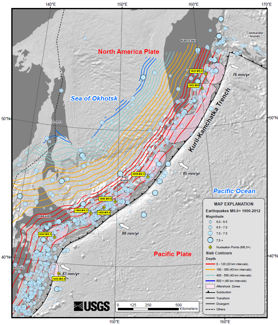
English: USGS map of the Kuril-Kamchatka trench, showing earthquake locations and depth contours on downgoing slab |
| Date | |
| Source | USGS summary of the 2013 Sea of Okhotsk earthquake |
| Author | USGS |
Licensing
edit
This image is in the public domain in the United States because it only contains materials that originally came from the United States Geological Survey, an agency of the United States Department of the Interior. For more information, see the official USGS copyright policy.
|
File history
Click on a date/time to view the file as it appeared at that time.
| Date/Time | Thumbnail | Dimensions | User | Comment | |
|---|---|---|---|---|---|
| current | 14:41, 25 May 2013 | | 911 × 1,063 (1.06 MB) | Mikenorton (talk | contribs) | User created page with UploadWizard |
You cannot overwrite this file.
File usage on Commons
There are no pages that use this file.
File usage on other wikis
The following other wikis use this file:
- Usage on cs.wikipedia.org
- Usage on el.wikipedia.org
- Usage on en.wikipedia.org
- Usage on id.wikipedia.org
- Usage on it.wikipedia.org