File:L'Europe Dediée a Monseigneur Monseigneur le Tellier Secret(aire) d'Estat &c. Par N. Sanson le fils Geographe du Roy - btv1b550137605 (084 of 114).jpg

Original file (5,242 × 4,053 pixels, file size: 2.97 MB, MIME type: image/jpeg)
Captions
Captions
Summary edit
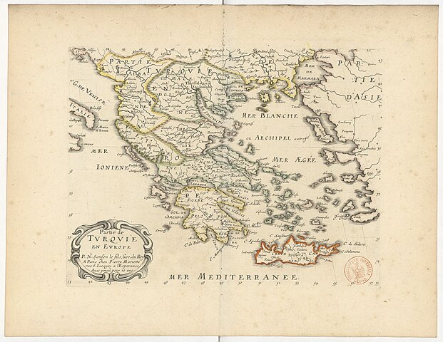
| L'Europe Dediée a Monseigneur Monseigneur le Tellier Secret[aire] d'Estat &c. Par N. Sanson le fils Geographe du Roy
( |
|||||||||||||||||||||||||||
|---|---|---|---|---|---|---|---|---|---|---|---|---|---|---|---|---|---|---|---|---|---|---|---|---|---|---|---|
| Author |
Sanson, Nicolas (1600-1667). Cartographe Sanson, Nicolas (1626?-1648). Cartographe Le Tellier, Michel (1603-1685). Dédicataire Sanson, Nicolas (1626?-1648). Fonction indéterminée Peyrounin, Abraham (1620-1666). Graveur |
||||||||||||||||||||||||||
| Title |
L'Europe Dediée a Monseigneur Monseigneur le Tellier Secret[aire] d'Estat &c. Par N. Sanson le fils Geographe du Roy |
||||||||||||||||||||||||||
| Description |
Français : Sujet : Europe
Comprend : Europe / Par N. Sanson le fils Geographe du roy ; Isles Britanniques / P[ar] N. Sanson le fils Geographe du roy ; A. Peyrounin sculp. ; Scandinavie ou sont les estats de Danemark, de Suede &c / Par N. Sanson le fils, Geogr[aphe] du roy. A. Peyrounin sculp. ; Russie Blanche ou Moscovie / Par N. Sanson le Fils Geog[raphe] du Roi ; A. Peyrounin sculp. ; France / Par N. Sanson le fils Geog[raphe] du Roi ; A. Peyrounin sculp. ; Allemagne / Par N. Sanson le fils Geog[raphe] du Roi ; A. Peyrounin sculp. ; Hongrie &c / Par N. Sanson le Fils Geog[raphe] du Roy ; Estats de la couronne de Pologne / P[ar] N. Sanson le fils G[eographe] du R[oi] ; Espagne / P[ar] N. Sanson le fils, Ge[ographe] du R[oi] ; Italie / Par N. Sanson le fils Geo[graphe] du R[oi] ; A. Peyrounin sculp. ; Partie de Turquie en Europe / Par N. Sanson le Fils, Geog[raphe] du Roi ; Mer Noire ou Mer Maieure / Par N. Sanson le fils Geographe du Roi Couverture : Monde Langue : français |
||||||||||||||||||||||||||
| Date | 1665 | ||||||||||||||||||||||||||
| Collection |
|
||||||||||||||||||||||||||
| References |
Français : Notice du catalogue : http://catalogue.bnf.fr/ark:/12148/cb40618490j |
||||||||||||||||||||||||||
| Source/Photographer |
Français : Bibliothèque nationale de France, département Cartes et plans, GE FF-8881
Bibliothèque nationale de France (84/114) |
||||||||||||||||||||||||||
| Permission (Reusing this file) |
|
||||||||||||||||||||||||||

_d%27Estat_%26c._Par_N._Sanson_le_fils_Geographe_du_Roy_-_btv1b550137605_(084_of_114).jpg&action=edit§ion=1)
File history
Click on a date/time to view the file as it appeared at that time.
| Date/Time | Thumbnail | Dimensions | User | Comment | |
|---|---|---|---|---|---|
| current | 21:03, 27 July 2022 | | 5,242 × 4,053 (2.97 MB) | Gzen92Bot (talk | contribs) | Gallica btv1b550137605 |
You cannot overwrite this file.
File usage on Commons
The following page uses this file:
_d%27Estat_%26c._Par_N._Sanson_le_fils_Geographe_du_Roy_-_btv1b550137605_(084_of_114).jpg)
_d%27Estat_%26c._Par_N._Sanson_le_fils_Geographe_du_Roy_-_btv1b550137605_(084_of_114).jpg&oldid=856640840)