File:Lääne-Virumaa vallad.svg

Size of this PNG preview of this SVG file: 403 × 416 pixels. Other resolutions: 232 × 240 pixels | 465 × 480 pixels | 744 × 768 pixels | 992 × 1,024 pixels | 1,984 × 2,048 pixels.
Original file (SVG file, nominally 403 × 416 pixels, file size: 533 KB)
Captions
Captions
Add a one-line explanation of what this file represents
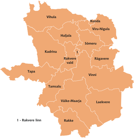
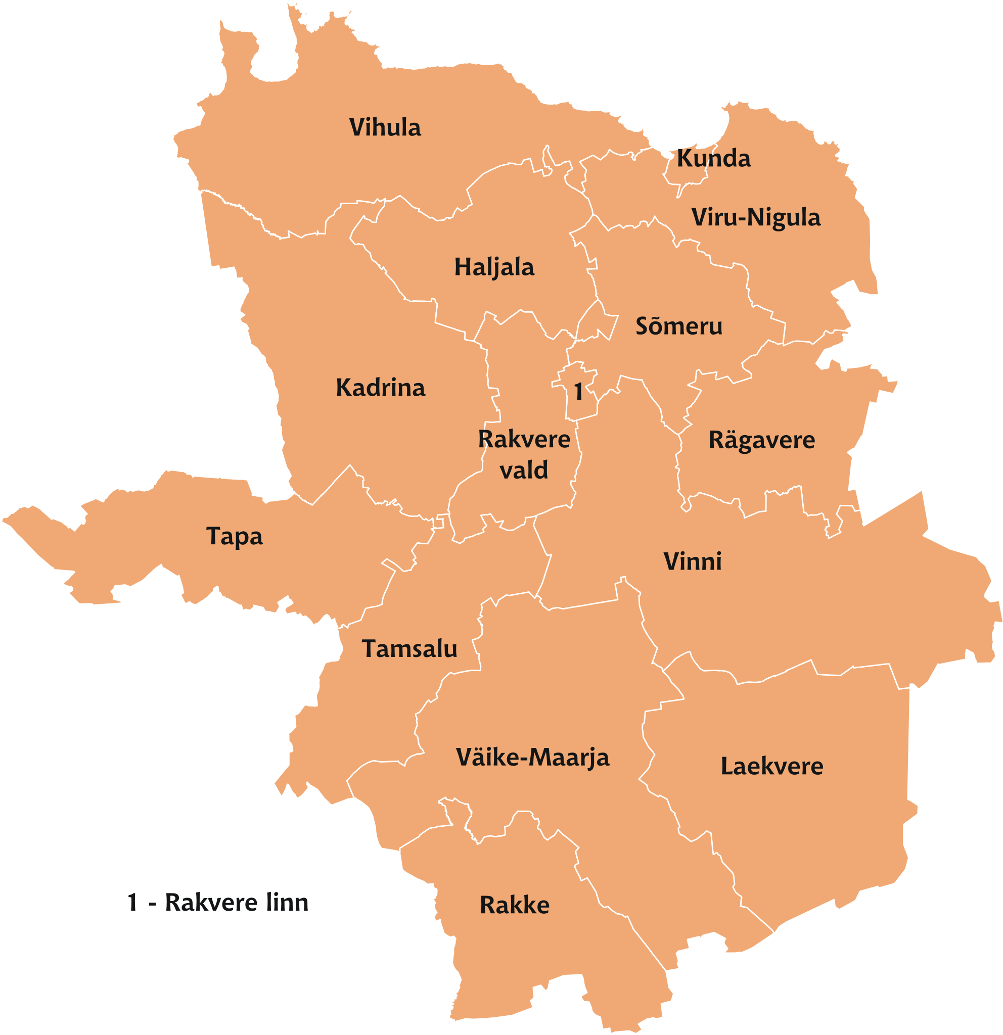
Municipalities of Lääne-Viru county.

|
This map uses administrative map from Estonian Land Board (1.2006) as its data source. Reproduction is authorised, provided the data source is acknowledged and validity date is provided.
Eesti: Andmete kasutamisel tuleb viitena ära märkida andmeallikana Maa-amet ning viidata andmete seisule.
|
File history
Click on a date/time to view the file as it appeared at that time.
| Date/Time | Thumbnail | Dimensions | User | Comment | |
|---|---|---|---|---|---|
| current | 17:47, 6 January 2007 | | 403 × 416 (533 KB) | Urmas (talk | contribs) |
You cannot overwrite this file.
File usage on Commons
The following page uses this file:
File usage on other wikis
The following other wikis use this file:
- Usage on az.wikipedia.org
- Usage on pt.wikipedia.org