File:Lölling - Erzquetsche2.jpg

Size of this preview: 800 × 565 pixels. Other resolutions: 320 × 226 pixels | 640 × 452 pixels | 1,024 × 723 pixels | 1,280 × 903 pixels | 2,560 × 1,807 pixels | 3,940 × 2,781 pixels.
Original file (3,940 × 2,781 pixels, file size: 4.22 MB, MIME type: image/jpeg)
Captions
Captions
Add a one-line explanation of what this file represents
Summary
edit
| Description | |
| Date | |
| Source | Own work |
| Author | Mefusbren69 |
| Permission (Reusing this file) |
PD |
| Camera location | | View this and other nearby images on: OpenStreetMap |
|---|
Licensing
edit
| I, the copyright holder of this work, release this work into the public domain. This applies worldwide. In some countries this may not be legally possible; if so: I grant anyone the right to use this work for any purpose, without any conditions, unless such conditions are required by law. |
File history
Click on a date/time to view the file as it appeared at that time.
| Date/Time | Thumbnail | Dimensions | User | Comment | |
|---|---|---|---|---|---|
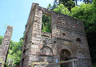
| current | 12:01, 1 July 2010 | | 3,940 × 2,781 (4.22 MB) | Mefusbren69 (talk | contribs) | == {{int:filedesc}} == {{Information |Description={{en|1=Ruin of the Ore-squeeze Locality:Lölling Community:Hüttenberg}} {{de|1=Ruinen der Erzquetsche Ort:Lölling Gemeinde:Hüttenberg}} |Source= |
You cannot overwrite this file.
File usage on Commons
The following page uses this file: