File:LA2-stridfin-map-oulu.png

Original file (1,534 × 1,304 pixels, file size: 180 KB, MIME type: image/png)
Captions
Captions
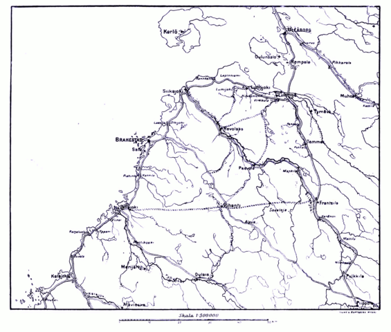
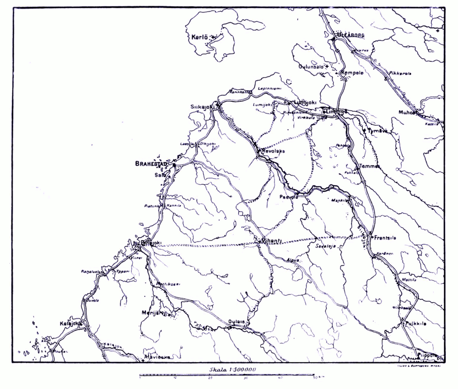
| Description | Map of the region south of en:Oulu, during the en:Finnish War | ||||
| Date | Map printed 1909, scanned and postprocessed by Lars Aronsson, January 11, 2008. | ||||
| Source | Map II. Page 61, Hugo Schulman, Striden om Finland 1808-1809 (1909) | ||||
| Author | The cartographer is unnamed; the corporate name Lilius & Hertzberg (publishers, Helsinki) is mentioned in some places. | ||||
| Permission (Reusing this file) |
|
||||
File history
Click on a date/time to view the file as it appeared at that time.
| Date/Time | Thumbnail | Dimensions | User | Comment | |
|---|---|---|---|---|---|
| current | 17:21, 11 January 2008 | | 1,534 × 1,304 (180 KB) | LA2 (talk | contribs) | {{Information |Description=Map of the region south of en:Oulu, during the en:Finnish War |Source=Map II. [http://runeberg.org/stridfin/0077.html Page 61], Hugo Schulman, ''Striden om Finland 1808-1809'' (1909) |Date=Map printed 1909, scanned an |
You cannot overwrite this file.
File usage on Commons
There are no pages that use this file.