File:LANDSAT New Year Island NT.png
No higher resolution available.
LANDSAT_New_Year_Island_NT.png (502 × 248 pixels, file size: 218 KB, MIME type: image/png)
Captions
Captions
Add a one-line explanation of what this file represents
Summary
edit
| Description |
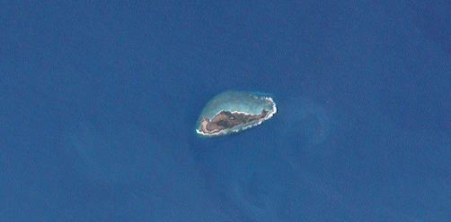
English: LANDSAT true color image of New Year Island, Northern Territory, Australia. |
| Date | |
| Source | http://oceancolor.gsfc.nasa.gov/cgi/landsat.pl?path=105&row=68&x=3040&y=-2590&sub=main_page&n=0&t=321 |
| Author | NASA |
| Camera location | | View this and other nearby images on: OpenStreetMap |
|---|
Licensing
edit
| This file is in the public domain in the United States because it was solely created by NASA. NASA copyright policy states that "NASA material is not protected by copyright unless noted". (See Template:PD-USGov, NASA copyright policy page or JPL Image Use Policy.) | ||
 |
Warnings:
|
File history
Click on a date/time to view the file as it appeared at that time.
| Date/Time | Thumbnail | Dimensions | User | Comment | |
|---|---|---|---|---|---|
| current | 15:15, 22 May 2016 | | 502 × 248 (218 KB) | Ordinary Person (talk | contribs) | User created page with UploadWizard |
You cannot overwrite this file.
File usage on Commons
The following page uses this file:
File usage on other wikis
The following other wikis use this file:
- Usage on ceb.wikipedia.org
- Usage on de.wikipedia.org
- Usage on en.wikipedia.org
- Usage on it.wikipedia.org
- Usage on www.wikidata.org