File:LA County Incorporated Areas Beverly Hills highlighted.svg

Size of this PNG preview of this SVG file: 730 × 599 pixels. Other resolutions: 292 × 240 pixels | 585 × 480 pixels | 935 × 768 pixels | 1,247 × 1,024 pixels | 2,494 × 2,048 pixels | 950 × 780 pixels.
Original file (SVG file, nominally 950 × 780 pixels, file size: 156 KB)
Captions
Captions
Add a one-line explanation of what this file represents
Summary
edit
| Description |
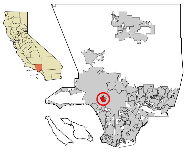
Beverly Hills is highlighted in red.
|
| Date | |
| Source | My own work, based on public domain information. Though I strove to be as accurate in the detail as possible, the information shown is not guaranteed to be completely accurate. |
| Author | Ixnayonthetimmay |
| Permission (Reusing this file) |
Public Domain |
| Other versions | See Category:Maps of Los Angeles County for other versions of this image. |
W3C-validity not checked.
Licensing
| I, the copyright holder of this work, release this work into the public domain. This applies worldwide. In some countries this may not be legally possible; if so: I grant anyone the right to use this work for any purpose, without any conditions, unless such conditions are required by law. |
File history
Click on a date/time to view the file as it appeared at that time.
| Date/Time | Thumbnail | Dimensions | User | Comment | |
|---|---|---|---|---|---|
| current | 10:53, 7 April 2013 | | 950 × 780 (156 KB) | Citypeek (talk | contribs) | another try |
| 09:20, 7 April 2013 |  | 950 × 780 (156 KB) | Citypeek (talk | contribs) | Another try | |
| 09:13, 7 April 2013 |  | 950 × 780 (156 KB) | Citypeek (talk | contribs) | Cleanup of file. Valid SVG now. | |
| 04:52, 29 June 2007 |  | 950 × 780 (262 KB) | Ixnayonthetimmay (talk | contribs) | == Summary == {{Information |Description=This map shows the incorporated areas in Los Angeles County, California. Beverly Hills is highlighted |
You cannot overwrite this file.
File usage on Commons
The following 5 pages use this file:
File usage on other wikis
The following other wikis use this file:
- Usage on af.wikipedia.org
- Usage on ang.wikipedia.org
- Usage on ar.wikipedia.org
- Usage on arz.wikipedia.org
- Usage on ast.wikipedia.org
- Usage on ca.wikipedia.org
- Usage on ceb.wikipedia.org
- Usage on cs.wikipedia.org
- Usage on cy.wikipedia.org
- Usage on de.wikipedia.org
- Usage on el.wikipedia.org
- Usage on eo.wikipedia.org
- Usage on es.wikipedia.org
- Usage on eu.wikipedia.org
- Usage on fa.wikipedia.org
- Usage on fi.wikipedia.org
- Usage on fr.wikipedia.org
- Usage on fy.wikipedia.org
- Usage on gd.wikipedia.org
- Usage on gl.wikipedia.org
- Usage on he.wikipedia.org
- Usage on hi.wikipedia.org
- Usage on hr.wikipedia.org
- Usage on ht.wikipedia.org
- Usage on hu.wikipedia.org
- Usage on id.wikipedia.org
- Usage on io.wikipedia.org
- Usage on it.wikipedia.org
- Usage on it.wikivoyage.org
- Usage on mk.wikipedia.org
- Usage on ml.wikipedia.org
- Usage on no.wikipedia.org
- Usage on pnb.wikipedia.org
- Usage on pt.wikipedia.org
- Usage on ro.wikipedia.org
- Usage on ru.wikipedia.org
- Usage on sh.wikipedia.org
- Usage on si.wikipedia.org
- Usage on sr.wikipedia.org
- Usage on th.wikipedia.org
- Usage on tr.wikipedia.org
- Usage on tt.wikipedia.org
- Usage on ur.wikipedia.org
- Usage on vi.wikipedia.org
- Usage on vo.wikipedia.org
- Usage on www.wikidata.org
- Usage on zh-min-nan.wikipedia.org
- Usage on zh.wikipedia.org