File:LEHIGH WATER GAP CHAINE BRIDGE TOLL HOUSE LEHIGH TWP NORTHAMPTON COUNTY PA.jpg

Size of this preview: 800 × 531 pixels. Other resolutions: 320 × 212 pixels | 640 × 425 pixels | 1,024 × 680 pixels | 1,280 × 850 pixels | 2,784 × 1,848 pixels.
Original file (2,784 × 1,848 pixels, file size: 1.14 MB, MIME type: image/jpeg)
Captions
Captions
Add a one-line explanation of what this file represents
Summary edit
| Description |
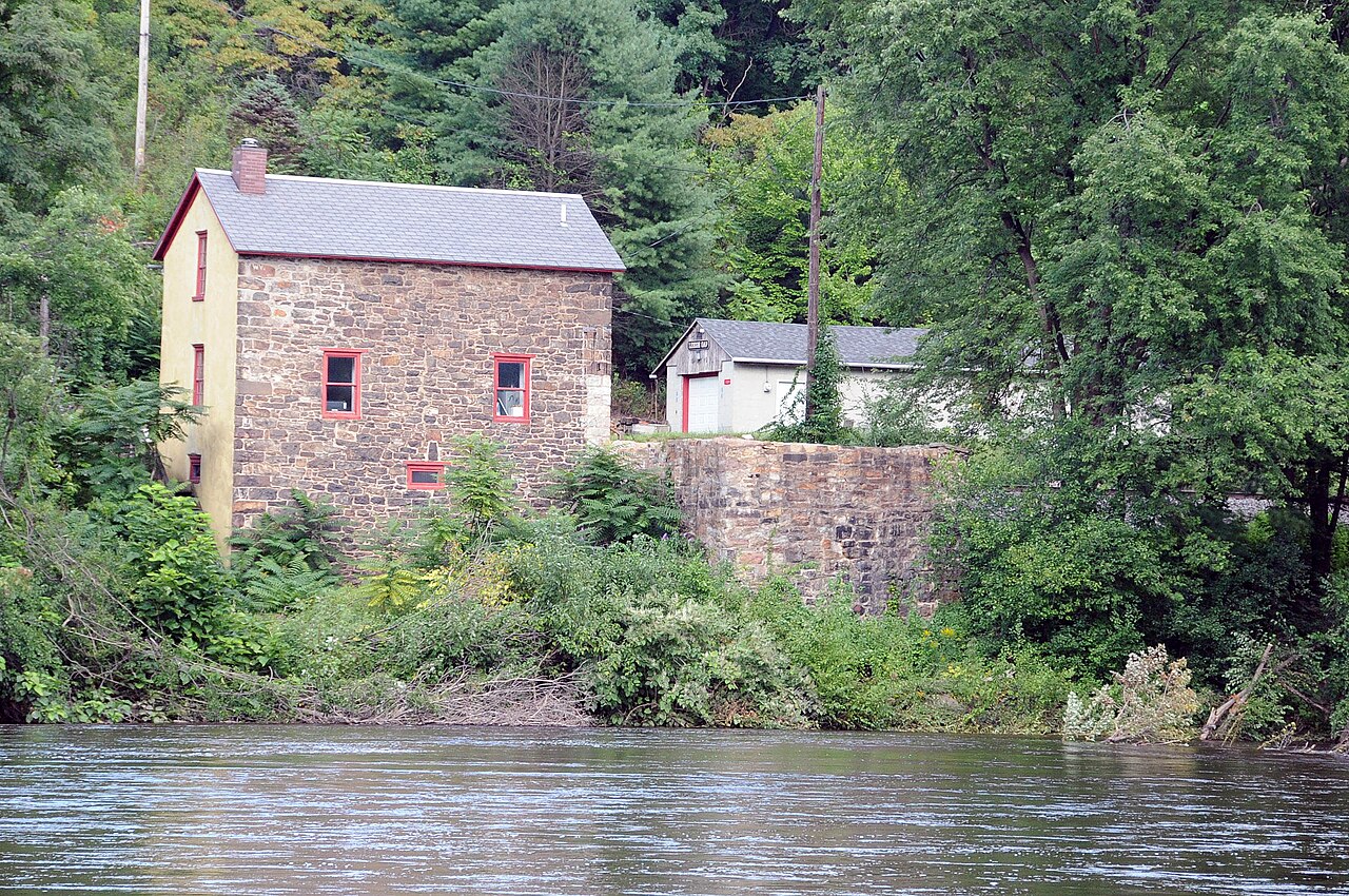
English: CONSTRUCTED CIRCA 1826 ACROSS THE LEHIGH RIVER IN UPPER NORTHAMPTON AND LEHIGH COUNTIES AT WHAT WAS CALLED WEIDER'S CROSSING ABOUT ½ MILE BELOW THE LEHIGH GAP PROPER. THE BRIDGE IS GONE BUT THE EAST BRIDGE ABUTMENT IS VISIBLE JUST TO THE RIGHT OF THE TOLL HOUSE |
| Date | |
| Source | Own work |
| Author | JERRYE & ROY KLOTZ, M.D. |
REF # 1000006837
Licensing edit
I, the copyright holder of this work, hereby publish it under the following license:
This file is licensed under the Creative Commons Attribution-Share Alike 4.0 International license.
- You are free:
- to share – to copy, distribute and transmit the work
- to remix – to adapt the work
- Under the following conditions:
- attribution – You must give appropriate credit, provide a link to the license, and indicate if changes were made. You may do so in any reasonable manner, but not in any way that suggests the licensor endorses you or your use.
- share alike – If you remix, transform, or build upon the material, you must distribute your contributions under the same or compatible license as the original.
File history
Click on a date/time to view the file as it appeared at that time.
| Date/Time | Thumbnail | Dimensions | User | Comment | |
|---|---|---|---|---|---|
| current | 11:16, 28 August 2021 | | 2,784 × 1,848 (1.14 MB) | KLOTZPLATE (talk | contribs) | Uploaded own work with UploadWizard |
You cannot overwrite this file.
File usage on Commons
There are no pages that use this file.
File usage on other wikis
The following other wikis use this file:
- Usage on en.wikipedia.org