File:LSCR Seymour River.jpg

Size of this preview: 800 × 600 pixels. Other resolutions: 320 × 240 pixels | 640 × 480 pixels | 1,024 × 768 pixels | 1,280 × 960 pixels | 2,560 × 1,920 pixels | 3,264 × 2,448 pixels.
Original file (3,264 × 2,448 pixels, file size: 1.87 MB, MIME type: image/jpeg)
Captions
Captions
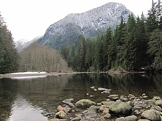
Seymour River at the Lower Seymour Conservation Reserve
Summary
edit
| Description |
English: Seymour River near Coho Trail (Old growth trail) near northern end of Seymour Valley Trailway. View southwest looking towards mountains including the Needles.
Lower Seymour Conservation Reserve, North Vancouver BC |
| Date | |
| Source | https://www.flickr.com/photos/78307739@N05/6957834172/ |
| Author | Flickstorage |
| Camera location | | View this and other nearby images on: OpenStreetMap |
|---|
Licensing
edit
This file is licensed under the Creative Commons Attribution 2.0 Generic license.
- You are free:
- to share – to copy, distribute and transmit the work
- to remix – to adapt the work
- Under the following conditions:
- attribution – You must give appropriate credit, provide a link to the license, and indicate if changes were made. You may do so in any reasonable manner, but not in any way that suggests the licensor endorses you or your use.
| This image was originally posted to Flickr by Flickstorage at https://flickr.com/photos/78307739@N05/6957834172. It was reviewed on 7 March 2023 by FlickreviewR 2 and was confirmed to be licensed under the terms of the cc-by-2.0. |
File history
Click on a date/time to view the file as it appeared at that time.
| Date/Time | Thumbnail | Dimensions | User | Comment | |
|---|---|---|---|---|---|
| current | 11:03, 7 March 2023 | | 3,264 × 2,448 (1.87 MB) | Mehehehea (talk | contribs) | Uploaded a work by Flickstorage from https://www.flickr.com/photos/78307739@N05/6957834172/ with UploadWizard |
You cannot overwrite this file.
File usage on Commons
There are no pages that use this file.
File usage on other wikis
The following other wikis use this file:
- Usage on en.wikipedia.org