File:La Prade Map 1888 of Chesterfield County (zoom on Black Heath Mines).jpg
Size of this preview: 800 × 600 pixels. Other resolutions: 320 × 240 pixels | 640 × 480 pixels | 960 × 720 pixels.
Original file (960 × 720 pixels, file size: 151 KB, MIME type: image/jpeg)
Captions
Captions
Add a one-line explanation of what this file represents
Summary
edit| Description |
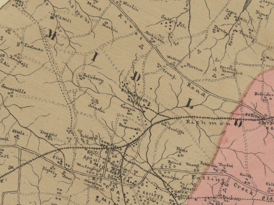
English: Map of Chesterfield County, Virginia 1888 (cropped to Midlothian mines area) |
| Date | |
| Source | This image is available from the United States Library of Congress's Prints and Photographs division under the digital ID g3883c.la001239. |
| Author | LaPrade, J. E. (Joseph Edgar), 1845-1903. |
| Other versions |
.jpg)
.jpg&action=edit§ion=1)
| Camera location | | View this and other nearby images on: OpenStreetMap |
|---|
.jpg¶ms=037.522465_N_-077.611810_E_globe:Earth_type:camera__&language=en)
Licensing
edit.jpg&action=edit§ion=2)
This work is in the public domain in the United States because it was published (or registered with the U.S. Copyright Office) before January 1, 1929.
Public domain works must be out of copyright in both the United States and in the source country of the work in order to be hosted on the Commons. If the work is not a U.S. work, the file must have an additional copyright tag indicating the copyright status in the source country.
Note: This tag should not be used for sound recordings. |
File history
Click on a date/time to view the file as it appeared at that time.
| Date/Time | Thumbnail | Dimensions | User | Comment | |
|---|---|---|---|---|---|
| current | 01:10, 27 April 2024 | | 960 × 720 (151 KB) | User-duck (talk | contribs) | File:La Prade Map 1888 of Chesterfield County (zoom on Midlothian Mines).jpg cropped 48 % horizontally, 21 % vertically using CropTool with lossless mode. |
You cannot overwrite this file.
File usage on Commons
The following 5 pages use this file:
- User:Chumwa/OgreBot/Public transport information/2024 April 21-30
- User:Chumwa/OgreBot/Transport Maps/2024 April 21-30
- User:Chumwa/OgreBot/Travel and communication maps/2024 April 21-30
- User:GeorgR (de)/Rail Transport in the US/2024 April
- File:La Prade Map 1888 of Chesterfield County (zoom on Midlothian Mines).jpg
File usage on other wikis
The following other wikis use this file:
- Usage on en.wikipedia.org
.jpg&oldid=874436827)