File:La Torre del Faro di Vada (Livorno).jpg

Size of this preview: 745 × 599 pixels. Other resolutions: 298 × 240 pixels | 597 × 480 pixels | 955 × 768 pixels | 1,273 × 1,024 pixels | 2,546 × 2,048 pixels | 4,600 × 3,701 pixels.
Original file (4,600 × 3,701 pixels, file size: 1.71 MB, MIME type: image/jpeg)
Captions
Captions
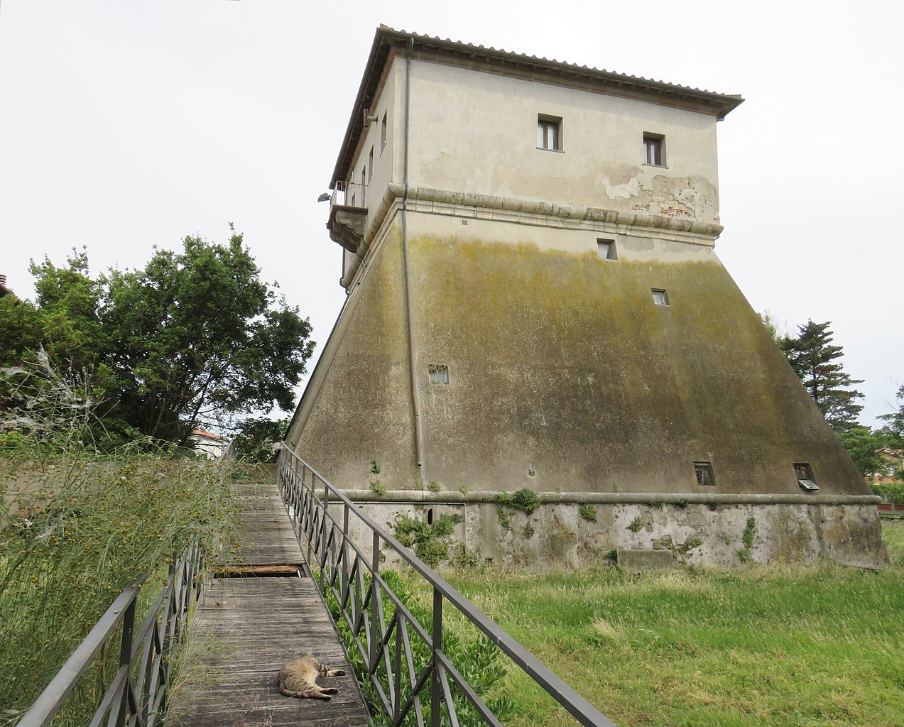
Dating back to 1279, born as a surveillance tower, it is now used as an environmental education laboratory
Summary
edit.jpg&action=edit§ion=1)
| Description |
Italiano: La Torre di Vada risalente al 1279 fu edificata dal Comune di Pisa, nel cui sistema portuale Vada era saldamente inserita, con la duplice funzione di vigilanza e di faro di supporto ai naviganti in un tratto di mare particolarmente insidioso. Alla fine del XV° secolo fu restaurata dal governo fiorentino, con un assetto politico del territorio completamente cambiato, fu un efficiente sistema di difesa costiero del nuovo stato regionale. Con altre torri l'intera costa toscana era totalmente controllata in special modo i convogli in arrivo ed in partenza, evitando al governo mediceo le spese di allestimento di una flotta. La Torre era circondata da un fossato comunicante con il mare. A fine 800 perse la sua funzione di controllo, e ad oggi la Torre del Faro è adibita a laboratorio di educazione ambientale.
English: The Torre di Vada dating back to 1279 was built by the Municipality of Pisa, in whose port system Vada was firmly inserted, with the dual function of surveillance and lighthouse to support mariners in a particularly insidious stretch of sea. At the end of the 15th century it was restored by the Florentine government, with a political structure of the territory completely changed, it was an efficient coastal defense system of the new regional state. With other towers, the entire Tuscan coast was totally controlled, especially the convoys arriving and departing, avoiding the Medici government the costs of setting up a fleet. The tower was surrounded by a moat communicating with the sea. At the end of the 19th century it lost its control function, and today the Torre del Faro is used as an environmental education laboratory. |
| Date | |
| Source | Own work |
| Author | PROPOLI87 |
| Camera location | | View this and other nearby images on: OpenStreetMap |
|---|
.jpg¶ms=043.350880_N_0010.454024_E_globe:Earth_type:camera__&language=en)
Licensing
edit.jpg&action=edit§ion=2)
I, the copyright holder of this work, hereby publish it under the following license:
This file is licensed under the Creative Commons Attribution-Share Alike 4.0 International license.
- You are free:
- to share – to copy, distribute and transmit the work
- to remix – to adapt the work
- Under the following conditions:
- attribution – You must give appropriate credit, provide a link to the license, and indicate if changes were made. You may do so in any reasonable manner, but not in any way that suggests the licensor endorses you or your use.
- share alike – If you remix, transform, or build upon the material, you must distribute your contributions under the same or compatible license as the original.
This image has been assessed using the Quality image guidelines and is considered a Quality image.
|
File history
Click on a date/time to view the file as it appeared at that time.
| Date/Time | Thumbnail | Dimensions | User | Comment | |
|---|---|---|---|---|---|
| current | 15:41, 11 June 2020 | | 4,600 × 3,701 (1.71 MB) | Anna.Massini (talk | contribs) | Uploaded own work with UploadWizard |
You cannot overwrite this file.
File usage on Commons
The following 5 pages use this file:
File usage on other wikis
The following other wikis use this file:
- Usage on fr.wikipedia.org
.jpg&oldid=796628086)