File:La pavillon d'Israel (Biennale d'architecture 2014, Venise) (15766751411).jpg
Original file (1,569 × 1,183 pixels, file size: 277 KB, MIME type: image/jpeg)
Captions
Captions
Summary
edit_(15766751411).jpg&action=edit§ion=1)
| Description |
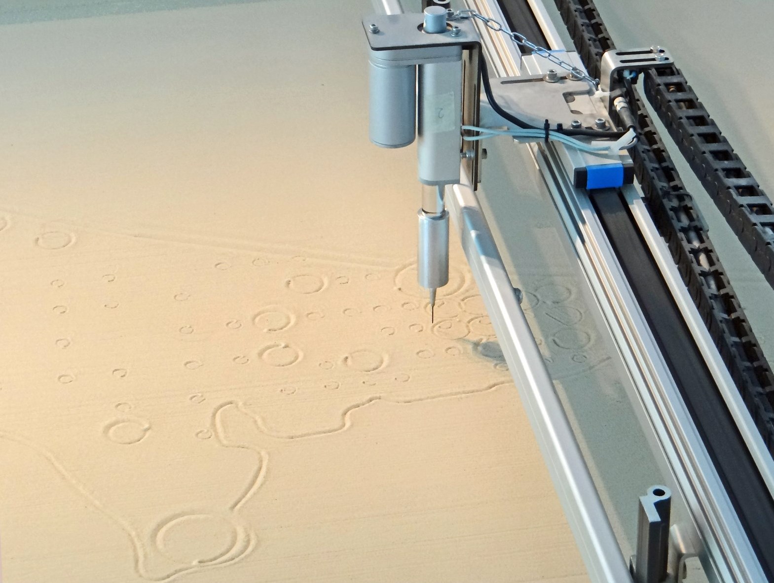
Tracés sur le sable par une table graphique de schémas d'aménagement du territoire en Israel Dans le pavillon national d'Israel, plusieurs tables graphiques ont été placées sur le sol, mais les tracés s'effectuent sur un lit de sable avec une pointe. Ce dispositif symbolise le processus constructif de l'état d'Israel qui, dans sa politique expansionniste, a privilégié la construction d'ilots d'habitations répartis sur le territoire plutôt que la création de cités importantes. La stratégie d'aménagement (master plan) initiée par A. Sharon en 1951 n'a pas visé le développement des centres urbains mais la construction de nouvelles unités d'habitation pour l'implantation de la population dans des zones rurales. Ce processus s'est poursuivi jusqu'à aujourd'hui. Le néologisme "Urburb" employé dans le pavillon d'Israel signifie qu'il ne décrit ni un site urbain, ni suburbain mais qu'il désigne une mosaïque fragmentée de sites d'habitations, le plus souvent de grande hauteur, issus d'une centaine d'années de planification en Israël. Ces mutations des espaces résidentiels dominent le paysage israélien contemporain et sont les reflets de la politique volontariste d'expansion continue de l'Etat d'Israel. C'est la réponse des concepteurs du pavillon à la question posée par Rem Koolhaas, commissaire général de la biennale internationale d'architecture de Venise en 2014. Le Urburb Ori Scialom, Roy Marque, Keren Yeala Golan Commissari: Michal Gov, Arad Turgeman . Curatori: Ori Scialom, Roy Marque, Keren Yeala Golan. Curatore Aggiunto: Edith Kofsky. www.youtube.com/watch?v=KPX1urcQEkE |
| Date | |
| Source | La pavillon d'Israel (Biennale d'architecture 2014, Venise) |
| Author | Jean-Pierre Dalbéra from Paris, France |
| Camera location | | View this and other nearby images on: OpenStreetMap |
|---|
_(15766751411).jpg¶ms=045.428747_N_0012.358928_E_globe:Earth_type:camera_source:Flickr_&language=en)
Licensing
edit_(15766751411).jpg&action=edit§ion=2)
- You are free:
- to share – to copy, distribute and transmit the work
- to remix – to adapt the work
- Under the following conditions:
- attribution – You must give appropriate credit, provide a link to the license, and indicate if changes were made. You may do so in any reasonable manner, but not in any way that suggests the licensor endorses you or your use.
| This image was originally posted to Flickr by dalbera at https://www.flickr.com/photos/72746018@N00/15766751411. It was reviewed on 9 December 2014 by FlickreviewR and was confirmed to be licensed under the terms of the cc-by-2.0. |
File history
Click on a date/time to view the file as it appeared at that time.
| Date/Time | Thumbnail | Dimensions | User | Comment | |
|---|---|---|---|---|---|
| current | 15:29, 15 December 2014 | | 1,569 × 1,183 (277 KB) | Lomita (talk | contribs) | Suppression cadre |
| 15:07, 9 December 2014 |  | 1,600 × 1,200 (313 KB) | Medium69 (talk | contribs) | Transferred from Flickr via Flickr2Commons |
You cannot overwrite this file.
File usage on Commons
The following page uses this file:
_(15766751411).jpg&oldid=752737705)