File:Laguna Bahía Toco Largo Bolivia Satellite map 59.60398W 16.png

Size of this preview: 800 × 550 pixels. Other resolutions: 320 × 220 pixels | 640 × 440 pixels | 1,024 × 703 pixels | 1,150 × 790 pixels.
Original file (1,150 × 790 pixels, file size: 1.85 MB, MIME type: image/png)
Captions
Captions
Add a one-line explanation of what this file represents
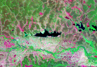
| Description | Vista satelital de la laguna Bahia Toco ubicada en el departamento de Santa Cruz (Bolivia). |
| Source | Nasa WorldWind |
| Author | NASA |
| This image is in the public domain because it is a screenshot from NASA’s globe software World Wind using a public domain layer, such as Blue Marble, MODIS, Landsat, SRTM, USGS or GLOBE.
|
 |
File history
Click on a date/time to view the file as it appeared at that time.
| Date/Time | Thumbnail | Dimensions | User | Comment | |
|---|---|---|---|---|---|
| current | 11:28, 2 October 2007 | | 1,150 × 790 (1.85 MB) | Paris88 (talk | contribs) | {{Information |Description= Vista satelital de la laguna Bahia Toco ubicada en el departamento de Santa Cruz (Bolivia). |Source= Nasa WorldWind |Date= |Author= NASA |Permission= |other_versions= }} {{PD-WorldWind}} [[Category:Satellite pictures of Bolivia |
You cannot overwrite this file.
File usage on Commons
There are no pages that use this file.
File usage on other wikis
The following other wikis use this file:
- Usage on ceb.wikipedia.org
- Usage on en.wikipedia.org
- Usage on es.wikipedia.org
- Usage on qu.wikipedia.org
- Usage on www.wikidata.org