File:Laguna del Pelado-Cerro 1er Tte Juárez A-XII-86.jpg

Size of this preview: 800 × 502 pixels. Other resolutions: 320 × 201 pixels | 640 × 402 pixels | 1,196 × 751 pixels.
Original file (1,196 × 751 pixels, file size: 161 KB, MIME type: image/jpeg)
Captions
Captions
Add a one-line explanation of what this file represents
Summary
edit
| Description |
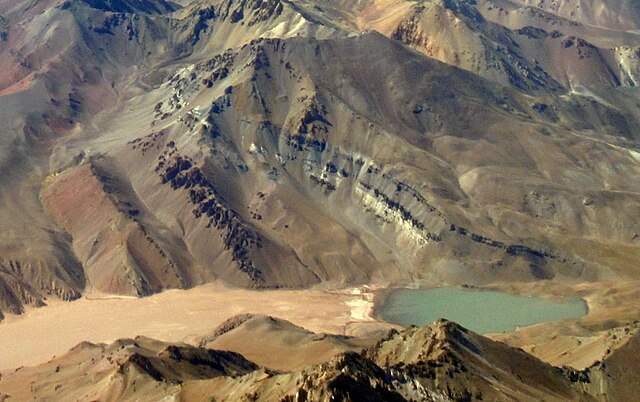
Español: La Laguna del Pelado (3594 m s.n.m.) al pie del Cerro 1er. Tte. Juárez A-XII-86 (4438 m s.n.m.)
Deutsch: Die Laguna del Pelado (3594 m ü.M.) am Fuß des Cerro 1er. Tte. Juárez A-XII-86 (4438 m ü.M.)
English: The Laguna del Pelado (3594 m a.s.l.) at the foot of Cerro 1er. Tte. Juárez A-XII-86 (4438 m a.s.l.) |
| Date | 3 December 2021, 09:52:18 (according to Exif data) |
| Source | Own work |
| Author | WeHaKa |
| Permission (Reusing this file) |
This file is licensed under the Creative Commons Attribution-Share Alike 4.0 International license. Attribution: WeHaKa
|
| Other versions |
This file was derived from:  |
| Camera location | | View this and other nearby images on: OpenStreetMap |
|---|
| Object location | | View this and other nearby images on: OpenStreetMap |
|---|
| Object location | | View this and other nearby images on: OpenStreetMap |
|---|
File history
Click on a date/time to view the file as it appeared at that time.
| Date/Time | Thumbnail | Dimensions | User | Comment | |
|---|---|---|---|---|---|
| current | 15:46, 28 May 2022 | | 1,196 × 751 (161 KB) | WeHaKa (talk | contribs) | {{Information |description = {{es| La Laguna del Pelado (3594 m s.n.m.) al pie del Cerro 1er. Tte. Juárez A-XII-86 (4438 m s.n.m.) }} {{de| Die Laguna del Pelado (3594 m ü.M.) am Fuß des Cerro 1er. Tte. Juárez A-XII-86 (4438 m ü.M.) }} {{en| The Laguna del Pelado (3594 m a.s.l.) at the foot of Cerro 1er. Tte. Juárez A-XII-86 (4438 m a.s.l.) }} |date = {{According to EXIF data|2021-12-03 09:52:18}} |source = {{own}} |author = WeHaKa |permission... |
You cannot overwrite this file.
File usage on Commons
There are no pages that use this file.
File usage on other wikis
The following other wikis use this file:
- Usage on www.wikidata.org