File:Lahaina WWTP map.jpg
Size of this preview: 463 × 599 pixels. Other resolutions: 185 × 240 pixels | 371 × 480 pixels | 900 × 1,165 pixels.
Original file (900 × 1,165 pixels, file size: 102 KB, MIME type: image/jpeg)
Captions
Captions
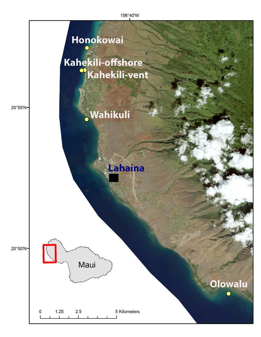
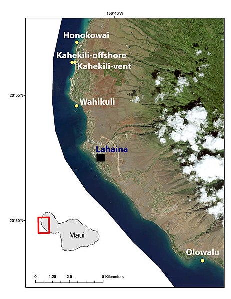
Map of northwestern side of Maui, highlighting the Lahaina wastewater treatment plant.
Summary
edit
| Description |
English: A map (along with an inset) of the northwestern shore area of the island of Maui, that highlights the location of the Lahaina Wastewater Treatment Plant and other nearby cities, as well as its proximity to the shoreline. |
| Date | |
| Source | From [1], Campbell, P.L., Prouty, N.G., Storlazzi, C.D., and D’Antonio, N.L., 2017, The use of passive membrane samplers to assess organic contaminant inputs at five coastal sites in west Maui, Hawaii: U.S. Geological Survey Open-File Report 2017-1097, 19 p., https://doi.org/10.3133/ofr20171097 |
| Author | United States Geological Survey |
Licensing
edit
This image is in the public domain in the United States because it only contains materials that originally came from the United States Geological Survey, an agency of the United States Department of the Interior. For more information, see the official USGS copyright policy.
|
File history
Click on a date/time to view the file as it appeared at that time.
| Date/Time | Thumbnail | Dimensions | User | Comment | |
|---|---|---|---|---|---|
| current | 19:56, 23 February 2019 | | 900 × 1,165 (102 KB) | Masem (talk | contribs) | User created page with UploadWizard |
You cannot overwrite this file.
File usage on Commons
The following page uses this file:
File usage on other wikis
The following other wikis use this file:
- Usage on en.wikipedia.org
- Usage on ru.wikipedia.org