File:Lake Midoriko survey.jpg

Size of this preview: 798 × 600 pixels. Other resolutions: 319 × 240 pixels | 639 × 480 pixels | 1,022 × 768 pixels | 1,280 × 962 pixels | 1,442 × 1,084 pixels.
Original file (1,442 × 1,084 pixels, file size: 355 KB, MIME type: image/jpeg)
Captions
Captions
Add a one-line explanation of what this file represents
Summary
edit
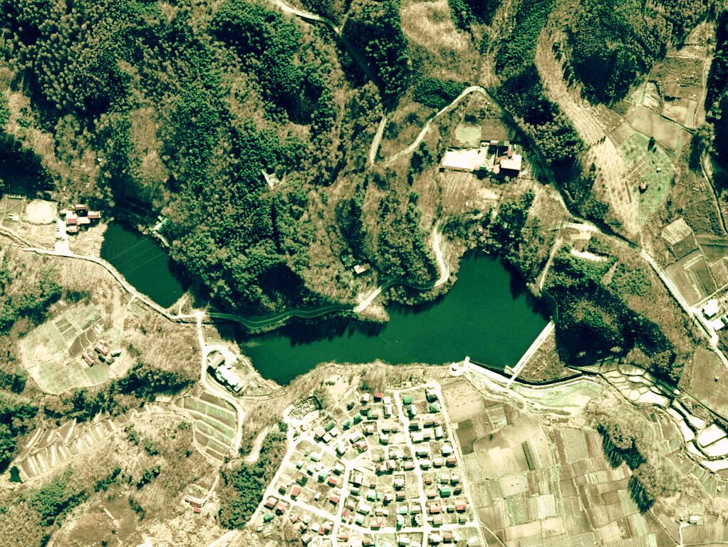
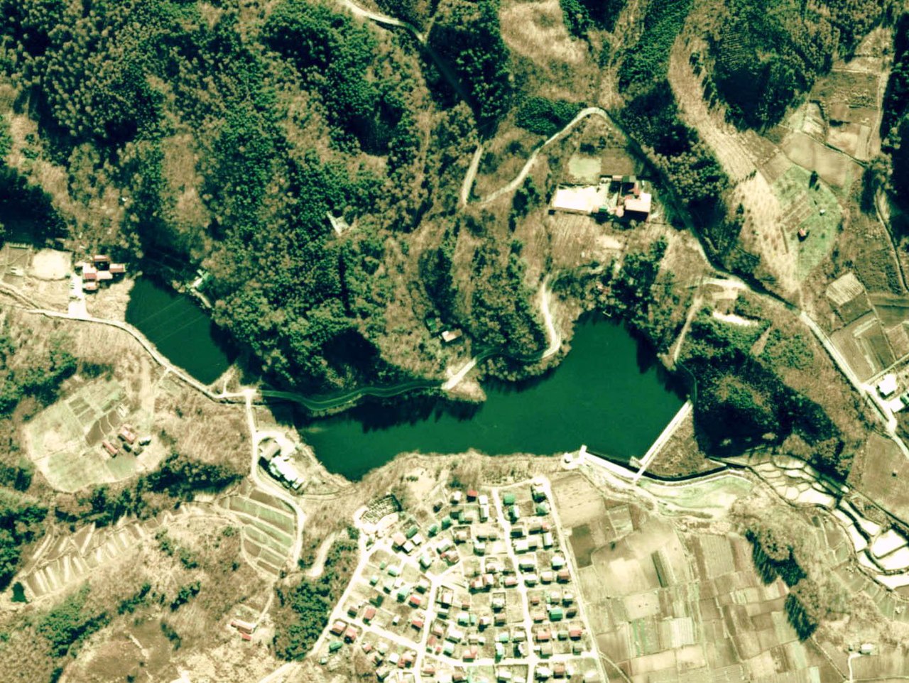
Aerial Photo of Lake Midoriko (1975), Shiojiri city, Nagano prefecture, Japan.
日本語:みどり湖の航空写真。1975年度撮影。
Licensing
edit

|
The copyright holder of this file, the Ministry of Land, Infrastructure, Transport and Tourism of Japan, allows anyone to use it for any purpose, provided that the copyright holder is properly attributed. Redistribution, derivative work, commercial use, and all other use is permitted. |
Attribution:
Copyright © National Land Image Information (Color Aerial Photographs), Ministry of Land, Infrastructure, Transport and Tourism
|
 |
This image is copyrighted by the Ministry of Land, Infrastructure, Transport and Tourism of Japan. For terms of use, see the stipulation to use of National Land Information (in Japanese) and message from MLIT (in Japanese and English). When you display this image on an article, include the following phrase in the description: "Made based on National Land Image Information (Color Aerial Photographs), Ministry of Land, Infrastructure, Transport and Tourism".
|
| Annotations | This image is annotated: View the annotations at Commons |
File history
Click on a date/time to view the file as it appeared at that time.
| Date/Time | Thumbnail | Dimensions | User | Comment | |
|---|---|---|---|---|---|
| current | 13:30, 1 February 2008 | | 1,442 × 1,084 (355 KB) | Qurren (talk | contribs) | Aerial Photo of Lake Midoriko (1975), Shiojiri city, Nagano prefecture, Japan. {{ja|みどり湖の航空写真。1975年度撮影。}} == Licensing == {{AerialPhotograph-mlitJP}} Category:Lake Midoriko |
You cannot overwrite this file.
File usage on Commons
There are no pages that use this file.
File usage on other wikis
The following other wikis use this file:
- Usage on ja.wikipedia.org