File:Lake Senba Mito Ibraki Aerial photography 20121013.jpg
Size of this preview: 800 × 374 pixels. Other resolutions: 320 × 150 pixels | 640 × 300 pixels | 1,049 × 491 pixels.
Original file (1,049 × 491 pixels, file size: 219 KB, MIME type: image/jpeg)
Captions
Captions
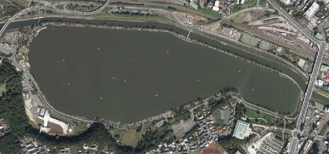
Aerial view of Lake Senba ,Mito , Ibaraki (Shooting:2012-10-13)
Summary
edit
| Description |
日本語: 国土地理院地図・空中写真閲覧サービス掲載の2012年10月13日に撮影された水戸市上空の空中写真。
English: Japan Geographical Survey Institute website posted. Aerial view over Mito City taken on October 13, 2012. |
| Date | |
| Source | 国土地理院地図・空中写真閲覧サービスより茨城県水戸市の千波湖周辺空中写真。2012-10-13撮影 整理番号CKT20125-C21-31 |
| Author | 国土地理院 |
Licensing
edit

|
This work is licensed under the Government of Japan Standard Terms of Use (Ver.2.0). The Terms of Use are compatible with the Creative Commons Attribution License 4.0 International. For the terms of use of this work, see this license page.
|
This file is licensed under the Creative Commons Attribution 4.0 International license.
Attribution: 国土地理院 (GSI)
- You are free:
- to share – to copy, distribute and transmit the work
- to remix – to adapt the work
- Under the following conditions:
- attribution – You must give appropriate credit, provide a link to the license, and indicate if changes were made. You may do so in any reasonable manner, but not in any way that suggests the licensor endorses you or your use.
File history
Click on a date/time to view the file as it appeared at that time.
| Date/Time | Thumbnail | Dimensions | User | Comment | |
|---|---|---|---|---|---|
| current | 00:18, 3 May 2020 | | 1,049 × 491 (219 KB) | 七巫こ (talk | contribs) | Uploaded a work by 国土地理院 from 国土地理院地図・空中写真閲覧サービスより茨城県水戸市の千波湖周辺空中写真。2012-10-13撮影 整理番号CKT20125-C21-31 with UploadWizard |
You cannot overwrite this file.
File usage on Commons
There are no pages that use this file.
File usage on other wikis
The following other wikis use this file:
- Usage on ja.wikipedia.org