File:Lake Shore Drive S-curve (355272762).jpg
Size of this preview: 800 × 380 pixels. Other resolutions: 320 × 152 pixels | 640 × 304 pixels | 1,411 × 670 pixels.
Original file (1,411 × 670 pixels, file size: 503 KB, MIME type: image/jpeg)
Captions
Captions
Add a one-line explanation of what this file represents
Summary edit
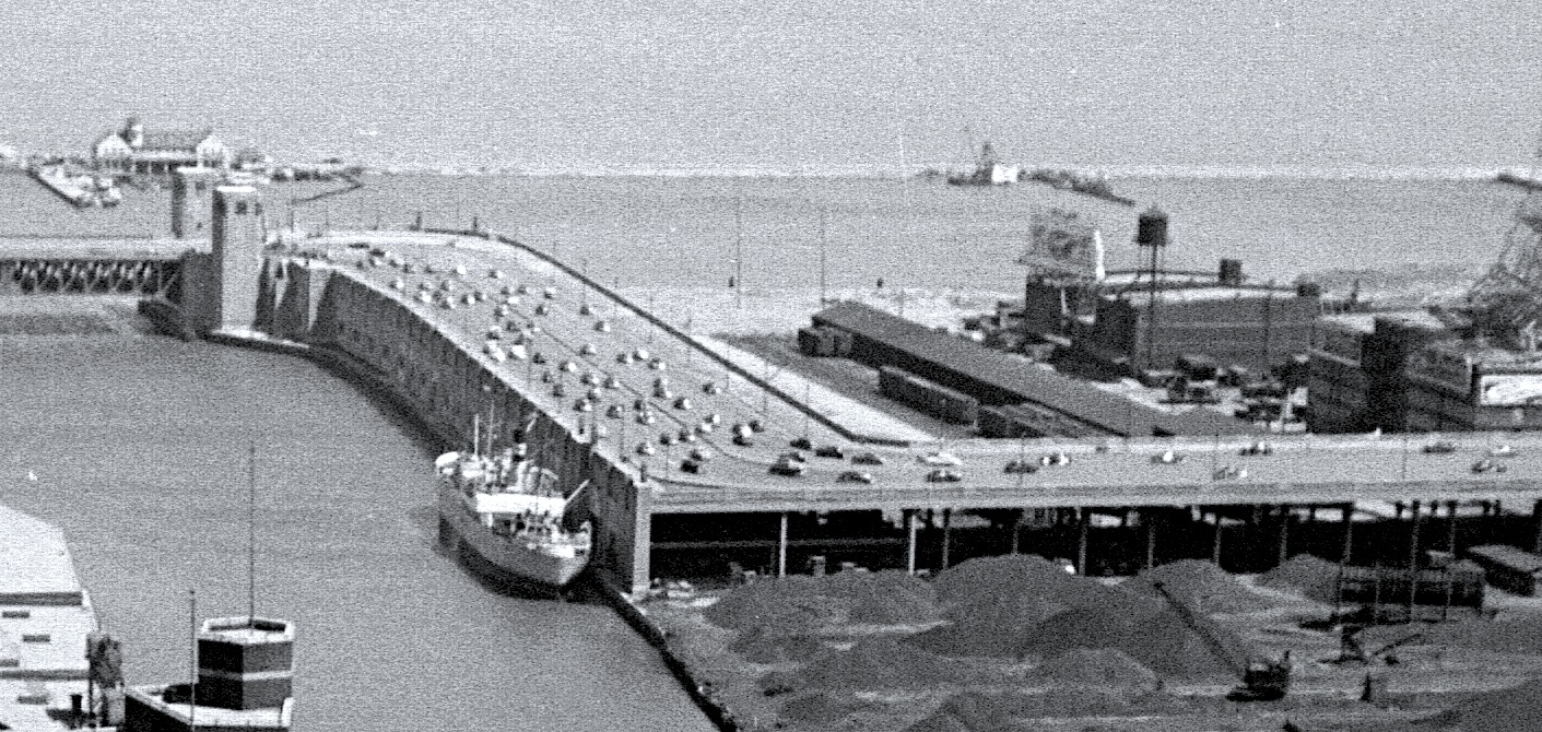
| Description |
There is the infamous S-curve of the Outer Drive. The North end of the IC freight yard is on the right. jarchie219@gmail.com |
| Date | |
| Source | 1950+A003021 |
| Author | Joe+Jeanette Archie |
| Other versions |
.jpg)
.jpg&action=edit§ion=1)
| Camera location | | View this and other nearby images on: OpenStreetMap |
|---|
.jpg¶ms=041.889998_N_-087.624556_E_globe:Earth_type:camera_source:Flickr_&language=en)
Licensing edit
.jpg&action=edit§ion=2)
This file is licensed under the Creative Commons Attribution 2.0 Generic license.
- You are free:
- to share – to copy, distribute and transmit the work
- to remix – to adapt the work
- Under the following conditions:
- attribution – You must give appropriate credit, provide a link to the license, and indicate if changes were made. You may do so in any reasonable manner, but not in any way that suggests the licensor endorses you or your use.
Chicago
File history
Click on a date/time to view the file as it appeared at that time.
| Date/Time | Thumbnail | Dimensions | User | Comment | |
|---|---|---|---|---|---|
| current | 21:25, 27 November 2018 | | 1,411 × 670 (503 KB) | SecretName101 (talk | contribs) | adjusted image |
| 00:28, 27 November 2018 |  | 1,411 × 670 (623 KB) | SecretName101 (talk | contribs) | File:1950+A003021 (3552727628).jpg cropped 58 % horizontally, 70 % vertically using CropTool with precise mode. |
You cannot overwrite this file.
File usage on Commons
The following 2 pages use this file:
.jpg&oldid=478975225)