File:LandSat-Chiquitos, Santa Cruz, Bolivia 1984.jpg
Size of this preview: 800 × 540 pixels. Other resolutions: 320 × 216 pixels | 640 × 432 pixels | 1,024 × 691 pixels | 1,280 × 864 pixels | 2,880 × 1,944 pixels.
Original file (2,880 × 1,944 pixels, file size: 1.44 MB, MIME type: image/jpeg)
Captions
Captions
Add a one-line explanation of what this file represents
Summary edit
| Description |
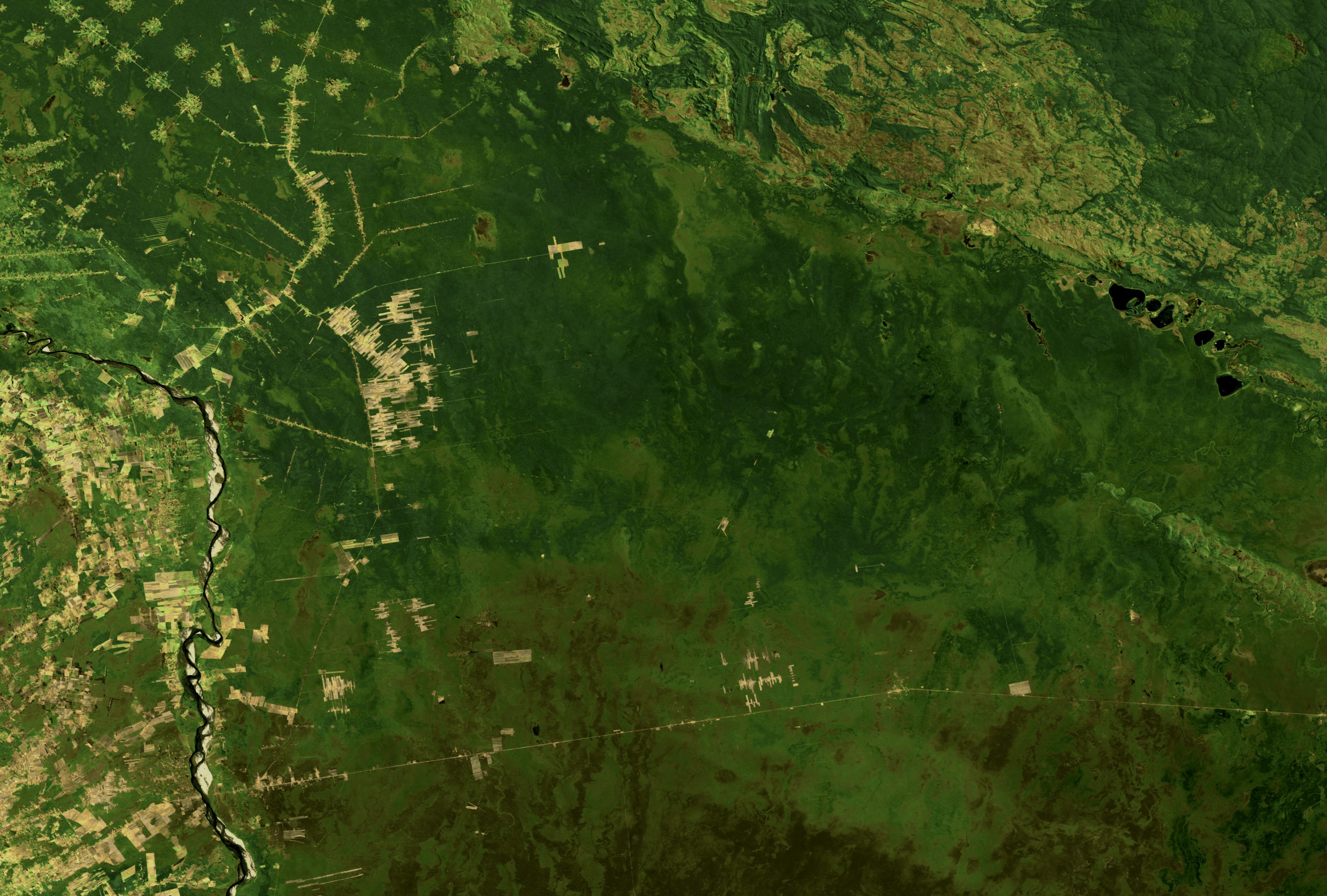
English: Satellite image of western Chiquitos and southern Ñuflo de Chávez provinces, Santa Cruz department, Bolivia in 1984. Illustrating early deforestation along roadways.
Español: Imagen de satelite Landsat del parte oeste de la provincia Chiquitos y parte sur de la provincia Ñuflo de Chávez, departamento de Santa Cruz, Bolivia. Está visible un poquito de deforestación al lado de los caminos. |
| Date | |
| Source | NASA Landsat Images presented online at https://svs.gsfc.nasa.gov/2096 |
| Author | NASA Landsat |
Licensing edit
| This file is in the public domain in the United States because it was solely created by NASA. NASA copyright policy states that "NASA material is not protected by copyright unless noted". (See Template:PD-USGov, NASA copyright policy page or JPL Image Use Policy.) | ||
 |
Warnings:
|
File history
Click on a date/time to view the file as it appeared at that time.
| Date/Time | Thumbnail | Dimensions | User | Comment | |
|---|---|---|---|---|---|
| current | 18:20, 12 August 2017 | | 2,880 × 1,944 (1.44 MB) | Carwil (talk | contribs) | User created page with UploadWizard |
You cannot overwrite this file.
File usage on Commons
There are no pages that use this file.
File usage on other wikis
The following other wikis use this file:
- Usage on en.wikipedia.org
- Usage on es.wikipedia.org
- Usage on it.wikipedia.org