File:Landappbw 127157 1824 Galgen Galgen Fuchsfalle.jpg

Size of this preview: 450 × 600 pixels. Other resolutions: 180 × 240 pixels | 360 × 480 pixels | 960 × 1,280 pixels.
Original file (960 × 1,280 pixels, file size: 267 KB, MIME type: image/jpeg)
Captions
Captions
Add a one-line explanation of what this file represents
Summary
edit
| Description |
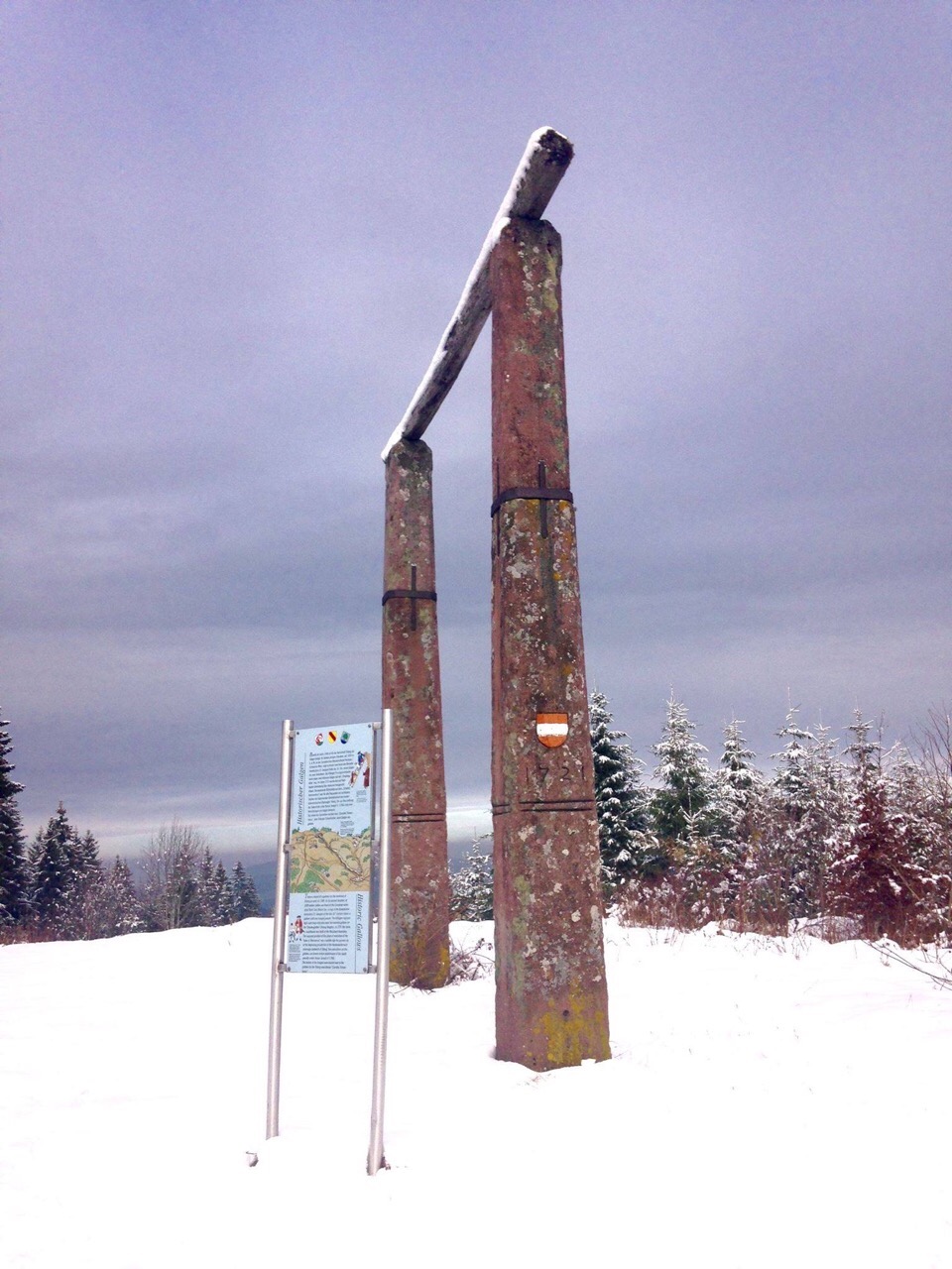
Deutsch: Bereits im Jahre 1349 ist für die Herrschaft Triberg ein Galgen belegt. An seinem jetzigen Standort, auf 1020 m u.d.M. an der Europäischen Wasserscheide Nordsee/Schwarzes Meer, zeigt erstmals eine Karte des Benediktinerklosters St. Georgen Ende des 16. Jhs. einen Galgen mit zwei Gehenkten. Die Villinger Pirschgerichtskarte weist sogar zwei hölzerne Galgen auf der "Dreyberghöhe" aus. Im Jahre 1721 wurde dort auf Nußbacher Gemarkung das steinerne Halsgericht erbaut. Die exponierte Richtstätte auf dem "Scheitel Alemanniens" war für alle Passanten ein sichtbares Zeichen der beginnenden Gerichtshoheit der vorderösterreichischen Obervogtei Triberg. Bis zur Abschaffung der Todesstrafe unter Kaiser Joseph II. (1786) sind zwei Hinrichtungen am Galgen bekannt.
Die Leiber der Gehenkten wurden vom "Carnifex Trimontanus", dem Triberger Scharfrichter, beim Galgen vergraben. von der Tafel am Galgen |
| Date | 6 July 2019, 16:55:07 (original upload date) |
| Source | overview - direct - dataset |
| Author | Hannah |
| Permission (Reusing this file) |
Creative Commons Zero (CC0) |
| ID | 127157 |
| Category | 1830 |
| Object location | | View this and other nearby images on: OpenStreetMap |
|---|
This media file was collected by Landauf, LandApp under the ID 127157. This tag does not indicate the copyright status of the attached work. A normal copyright tag is still required. See Commons:Licensing. |
Licensing
edit
| This file is made available under the Creative Commons CC0 1.0 Universal Public Domain Dedication. | |
| The person who associated a work with this deed has dedicated the work to the public domain by waiving all of their rights to the work worldwide under copyright law, including all related and neighboring rights, to the extent allowed by law. You can copy, modify, distribute and perform the work, even for commercial purposes, all without asking permission.
|
File history
Click on a date/time to view the file as it appeared at that time.
| Date/Time | Thumbnail | Dimensions | User | Comment | |
|---|---|---|---|---|---|
| current | 01:20, 30 April 2023 | | 960 × 1,280 (267 KB) | LaserlichtBot (talk | contribs) | =={{int:filedesc}}== {{Information |description={{de|1=Bereits im Jahre 1349 ist für die Herrschaft Triberg ein Galgen belegt. An seinem jetzigen Standort, auf 1020 m u.d.M. an der Europäischen Wasserscheide Nordsee/Schwarzes Meer, zeigt erstmals eine Karte des Benediktinerklosters St. Georgen Ende des 16. Jhs. einen Galgen mit zwei Gehenkten. Die Villinger Pirschgerichtskarte weist sogar zwei hölzerne Galgen auf der "Dreyberghöhe" aus. Im Jahre 1721 wurde dort auf Nußbacher Gemarkung das ste... |
You cannot overwrite this file.
File usage on Commons
The following page uses this file: