File:Landslide Buries Valley of the Geysers.jpg

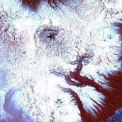
Size of this preview: 600 × 600 pixels. Other resolutions: 240 × 240 pixels | 480 × 480 pixels | 768 × 768 pixels | 1,024 × 1,024 pixels | 2,400 × 2,400 pixels.
Original file (2,400 × 2,400 pixels, file size: 3.84 MB, MIME type: image/jpeg)
Captions
Captions
Add a one-line explanation of what this file represents
Summary edit
| Description |
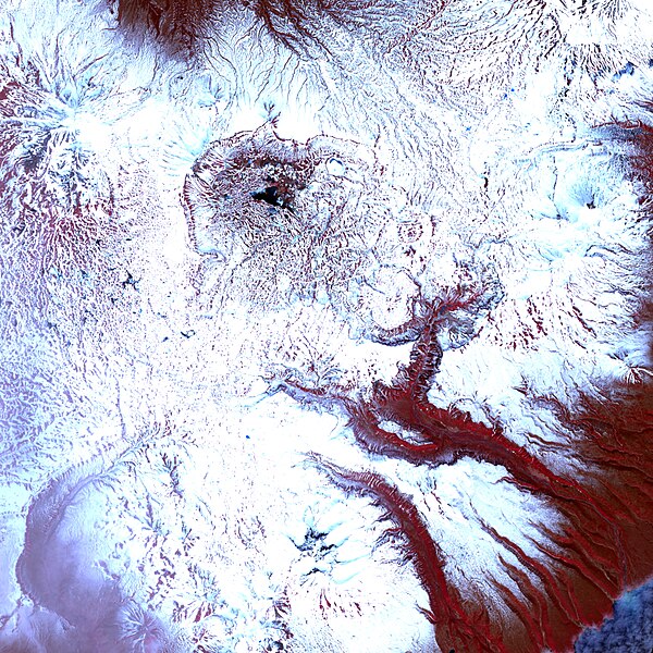
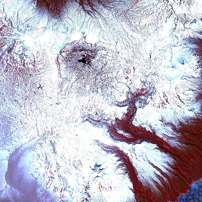
English: This infra-red-enhanced image shows the valley, the landslide, and a new thermal lake. Even in mid-June, just days from the start of summer, the landscape is generally covered in snow, though the geologically heated valley is relatively snow free. The tree-covered hills are red (the colour of vegetation in this false-colour treatment), providing a strong contrast to the aquamarine water and the grey-brown slide. |
| Date | |
| Source | http://earthobservatory.nasa.gov/IOTD/view.php?id=7789 |
| Author | Jesse Allen |
Image created using The Advanced Spaceborne Thermal Emission and Reflection Radiometer (ASTER) on NASA’s Terra satellite. Data provided courtesy of the NASA/GSFC/MITI/ERSDAC/JAROS, and U.S./Japan ASTER Science Team.
Licensing edit
| This file is in the public domain in the United States because it was solely created by NASA. NASA copyright policy states that "NASA material is not protected by copyright unless noted". (See Template:PD-USGov, NASA copyright policy page or JPL Image Use Policy.) | ||
 |
Warnings:
|
File history
Click on a date/time to view the file as it appeared at that time.
| Date/Time | Thumbnail | Dimensions | User | Comment | |
|---|---|---|---|---|---|
| current | 18:56, 5 July 2009 | | 2,400 × 2,400 (3.84 MB) | Originalwana (talk | contribs) | {{Information |Description={{en|1=This infra-red-enhanced image shows the valley, the landslide, and a new thermal lake. Even in mid-June, just days from the start of summer, the landscape is generally covered in snow, though the geologically heated valle |
You cannot overwrite this file.
File usage on Commons
There are no pages that use this file.
File usage on other wikis
The following other wikis use this file:
- Usage on ba.wikipedia.org
- Usage on ca.wikipedia.org
- Usage on el.wikipedia.org
- Usage on en.wikipedia.org
- Usage on fr.wikipedia.org
- Usage on it.wikipedia.org
- Usage on kn.wikipedia.org
- Usage on or.wikipedia.org
- Usage on ru.wikipedia.org
- Usage on ta.wikipedia.org