File:Langeness.png

Size of this preview: 800 × 493 pixels. Other resolutions: 320 × 197 pixels | 640 × 395 pixels | 981 × 605 pixels.
Original file (981 × 605 pixels, file size: 1.04 MB, MIME type: image/png)
Captions
Captions
Add a one-line explanation of what this file represents
Summary
edit
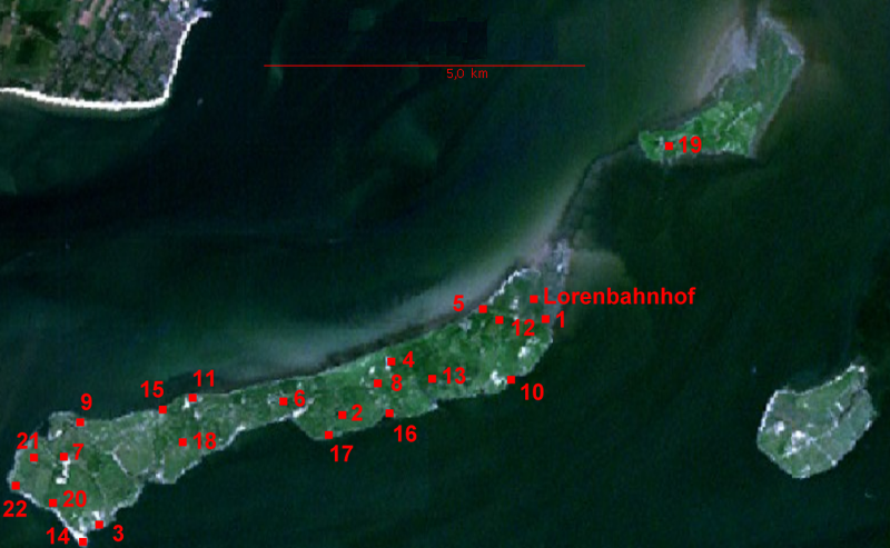
NASA World Wind screen image of Halligen Langeness and Oland, Germany. Numbers of settlements (terps) added by uploader
Licensing
edit
| This image is in the public domain because it is a screenshot from NASA’s globe software World Wind using a public domain layer, such as Blue Marble, MODIS, Landsat, SRTM, USGS or GLOBE.
|
 |
| Annotations | This image is annotated: View the annotations at Commons |
File history
Click on a date/time to view the file as it appeared at that time.
| Date/Time | Thumbnail | Dimensions | User | Comment | |
|---|---|---|---|---|---|
| current | 20:44, 4 December 2006 | | 981 × 605 (1.04 MB) | Ratzer (talk | contribs) | corrected version uploaded under same name |
| 20:32, 4 December 2006 |  | 981 × 605 (1.04 MB) | Ratzer (talk | contribs) | NASA World Wind screen image numbers of settlements (terps) added by uploader |
You cannot overwrite this file.
File usage on Commons
There are no pages that use this file.
File usage on other wikis
The following other wikis use this file:
- Usage on de.wikipedia.org
- Usage on eo.wikipedia.org
- Usage on fy.wikipedia.org
- Usage on ru.wikipedia.org
- Usage on tr.wikipedia.org