File:Larson -, Spiry-Eklo - and Travis 2 Site in Wolworth County, South Dakota.png
Size of this preview: 555 × 599 pixels. Other resolutions: 222 × 240 pixels | 445 × 480 pixels | 712 × 768 pixels | 949 × 1,024 pixels | 2,031 × 2,192 pixels.
Original file (2,031 × 2,192 pixels, file size: 2.56 MB, MIME type: image/png)
Captions
Captions
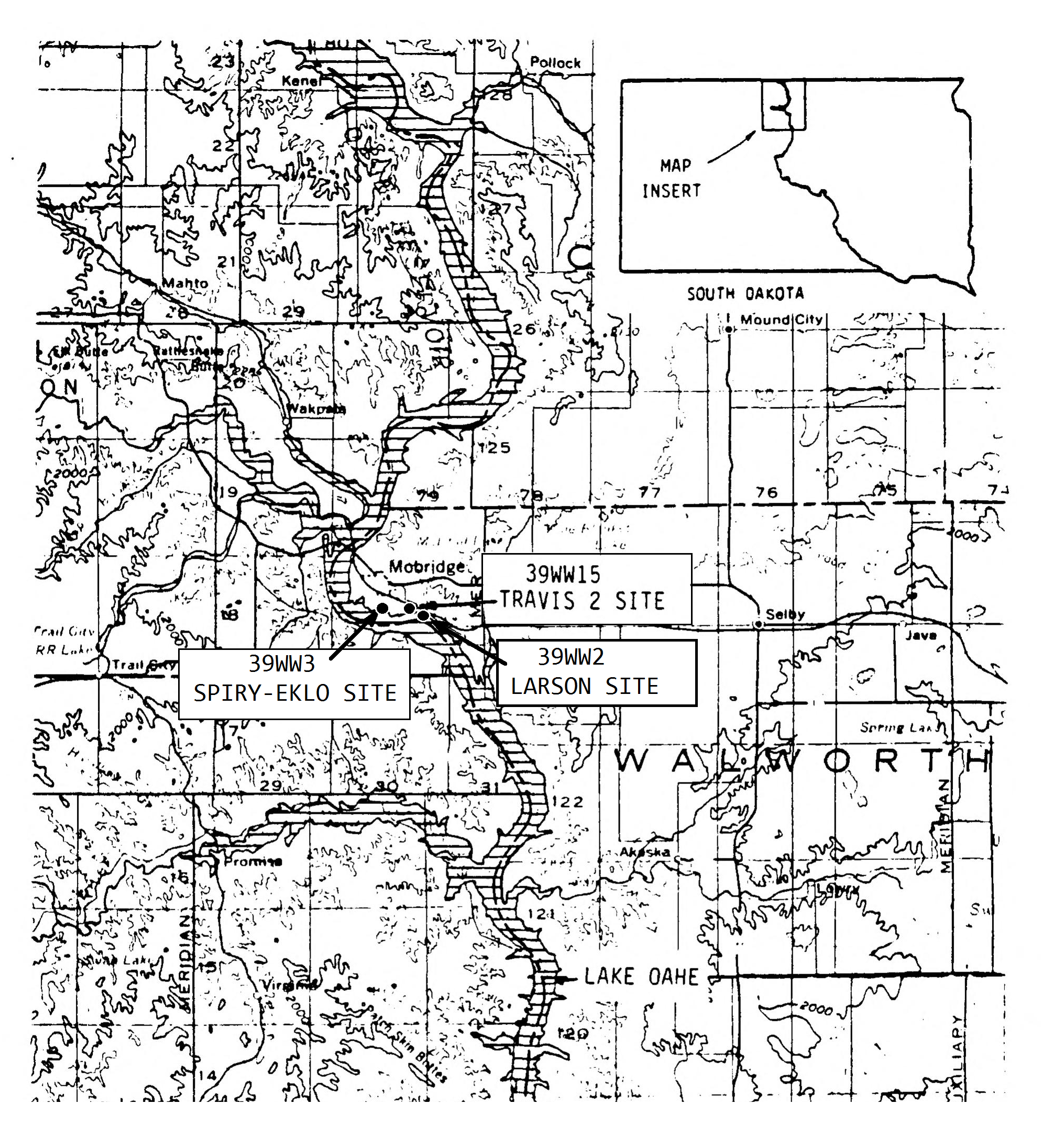
The map shows the location of Larson Site (39WW2), Travis 2 Site (39WW15) and Spiry-Eklo Site (39WW3) in Walworth County, South Dakota
Summary edit
| Description |
Dansk: Kortet viser placeringen af en by befolket af arikaraer fra ca. 1675 til senest 1750, Larson Site i South Dakota. Mindst 71 indbyggere blev dræbt under en massakre begået af andre indianere før 1750, hvorunder flere jordhytter blev stukket i brand. Kortet viser desuden er de arkæologiske steder Travis 2 og Spiry-Eklo tæt ved Larson.
English: The map shows the location of an Arikara village, Larson Site (39WW2), in Walworth County, South Dakota, used from cirka 1675 to latest 1750. Seventy-one victims of a massacre on the villagers inflicted by other natives were found during excavations i 1964. Some of the lodges were burned. The map also shows the nearby sites of Travis 2 and Spiry-Eklo. |
| Date | |
| Source | ”DTIC ADA245648: Results of the 1987 Archeological Investigations at the Travis 2 Site, 39WW15, Walworth County, South Dakota.” Page 2 (Detail of the map used and further adapted to text about Larson Site, (39WW2)) |
| Author | Creater: Defence Technical Information Center, 1988-09-01 |
Licensing edit
This work is in the public domain in the United States because it is a work prepared by an officer or employee of the United States Government as part of that person’s official duties under the terms of Title 17, Chapter 1, Section 105 of the US Code.
Note: This only applies to original works of the Federal Government and not to the work of any individual U.S. state, territory, commonwealth, county, municipality, or any other subdivision. This template also does not apply to postage stamp designs published by the United States Postal Service since 1978. (See § 313.6(C)(1) of Compendium of U.S. Copyright Office Practices). It also does not apply to certain US coins; see The US Mint Terms of Use.
|
 | |
| This file has been identified as being free of known restrictions under copyright law, including all related and neighboring rights. | ||

|
This is a file uploaded through the Danish Wikipedia, which has not been reviewed on Commons:
|
File history
Click on a date/time to view the file as it appeared at that time.
| Date/Time | Thumbnail | Dimensions | User | Comment | |
|---|---|---|---|---|---|
| current | 17:55, 16 July 2022 | | 2,031 × 2,192 (2.56 MB) | Indianertosset (talk | contribs) | Uploaded a work by Creater: Defence Technical Information Center, 1988-09-01 from ”DTIC ADA245648: Results of the 1987 Archeological Investigations at the Travis 2 Site, 39WW15, Walworth County, South Dakota.” Page 2 (Detail of the map used and further adapted to text about Larson Site, (39WW2)) with UploadWizard |
You cannot overwrite this file.
File usage on Commons
There are no pages that use this file.
File usage on other wikis
The following other wikis use this file:
- Usage on da.wikipedia.org