File:Las Vegas street circuit.png
Size of this preview: 800 × 525 pixels. Other resolutions: 320 × 210 pixels | 640 × 420 pixels | 1,024 × 672 pixels | 1,280 × 840 pixels | 2,193 × 1,440 pixels.
Original file (2,193 × 1,440 pixels, file size: 107 KB, MIME type: image/png)
Captions
Captions
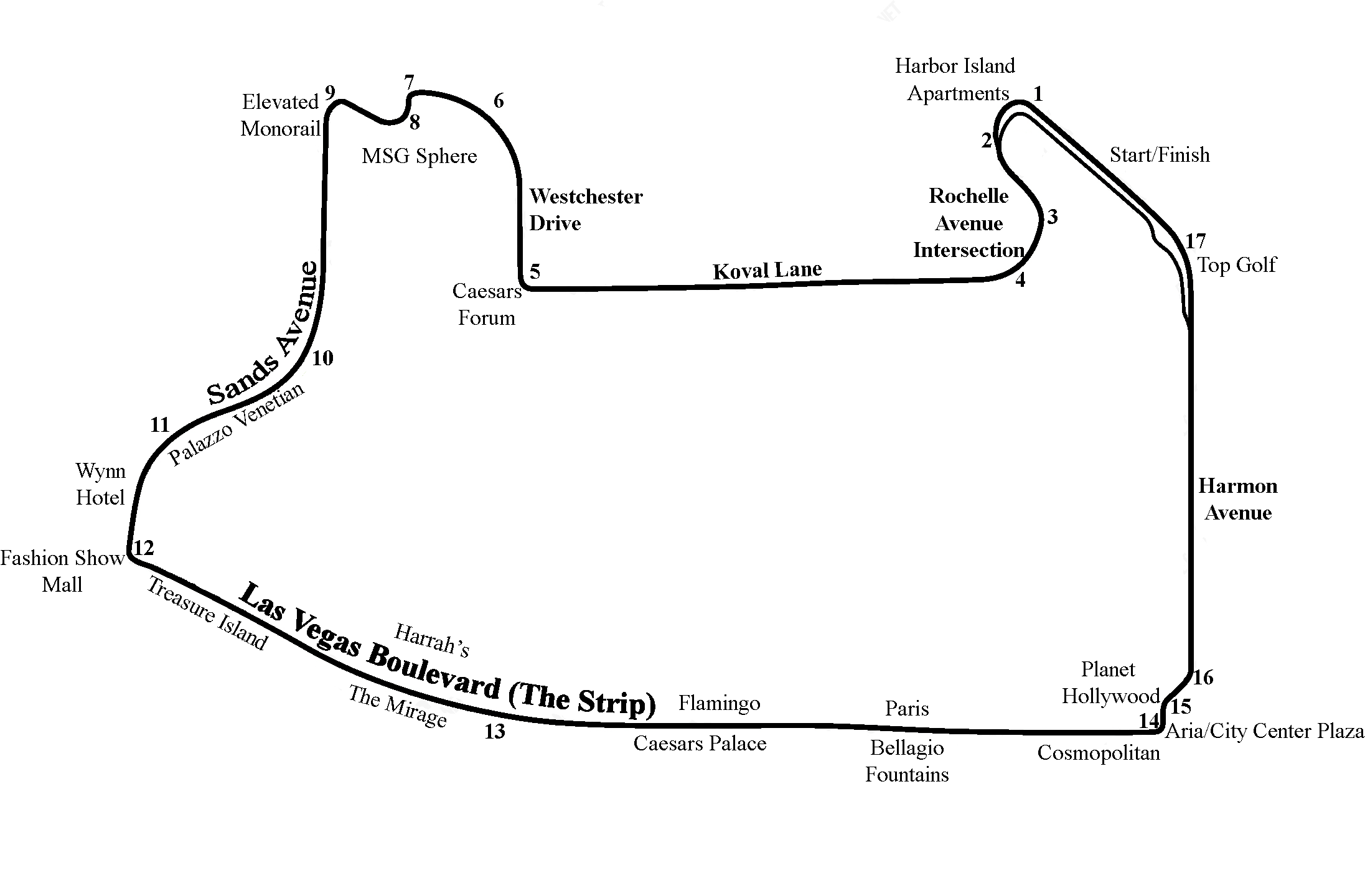
Las Vegas street circuit (F1)
Summary
edit
| Description |
English: Las Vegas street circuit (F1) |
| Date | |
| Source | Own work |
| Author | Hmdwgf |
Licensing
edit
I, the copyright holder of this work, hereby publish it under the following license:
This file is licensed under the Creative Commons Attribution-Share Alike 4.0 International license.
- You are free:
- to share – to copy, distribute and transmit the work
- to remix – to adapt the work
- Under the following conditions:
- attribution – You must give appropriate credit, provide a link to the license, and indicate if changes were made. You may do so in any reasonable manner, but not in any way that suggests the licensor endorses you or your use.
- share alike – If you remix, transform, or build upon the material, you must distribute your contributions under the same or compatible license as the original.
File history
Click on a date/time to view the file as it appeared at that time.
| Date/Time | Thumbnail | Dimensions | User | Comment | |
|---|---|---|---|---|---|
| current | 04:35, 5 February 2023 | | 2,193 × 1,440 (107 KB) | Hmdwgf (talk | contribs) | Some mods |
| 06:05, 18 December 2022 |  | 2,193 × 1,440 (107 KB) | Hmdwgf (talk | contribs) | Additional information | |
| 00:01, 22 November 2022 |  | 2,560 × 1,440 (106 KB) | Hmdwgf (talk | contribs) | Uploaded own work with UploadWizard |
You cannot overwrite this file.
File usage on Commons
The following 6 pages use this file:
- User:Chumwa/OgreBot/Transport Maps/2022 December 11-20
- User:Chumwa/OgreBot/Transport Maps/2022 November 21-30
- User:Chumwa/OgreBot/Transport Maps/2023 February 1-9
- User:Chumwa/OgreBot/Travel and communication maps/2022 December 11-20
- User:Chumwa/OgreBot/Travel and communication maps/2022 November 21-30
- User:Chumwa/OgreBot/Travel and communication maps/2023 February 1-9
File usage on other wikis
The following other wikis use this file:
- Usage on cs.wikipedia.org
- Usage on fi.wikipedia.org
- Usage on fr.wikipedia.org