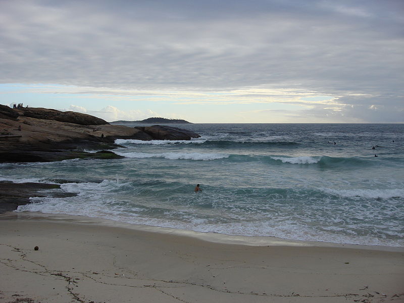
File:Lascar Leme beach (4551879156).jpg

Size of this preview: 800 × 600 pixels. Other resolutions: 320 × 240 pixels | 640 × 480 pixels | 1,024 × 768 pixels | 1,280 × 960 pixels | 2,592 × 1,944 pixels.
Original file (2,592 × 1,944 pixels, file size: 2.19 MB, MIME type: image/jpeg)
File information
Structured data
Captions
Captions
Add a one-line explanation of what this file represents
Summary edit
| DescriptionLascar Leme beach (4551879156).jpg | The North side of Copacabana Beach is named Leme. Using the lifeguard stations as reference, this is where you find Posto 1 (Posto 6 is on the other end, down South). Av. Princesa Isabel is the borderline between Copacabana and Leme (see map). The location is quite strategic, as you are minutes from Botafogo, Urca, Flamengo, and the historical parts of Downtown Rio. If you prefer to go underground, the Lido subway station is only a couple of blocks away. You are five to ten minutes away from South Copacabana or Ipanema. Morro do Leme, the beautiful hill at the end of the beach, is part of the Corcovado mountain range. This is where the neighborhood got its name from. Right around the hill there's Praia Vermelha, the largest beach in Urca. On top of Morro do Leme you will see a large flag of Brazil. It is placed on the spot of the old Forte do Vigia, built in the XVIII century to protect the city. Forte Duque de Caxias, more commonly known as Forte do Leme is on the foot of the hill. It is a newer strutcture, built in 1913, and now it's used by the army as a cultural center. Morro do Leme is partially circled by the fishermen's path (Caminho dos Pescadores), that was built in 1985. It's a great spot for you to take a panoramic photo of horse-shoe shaped Copacabana Beach. Leme has good hotels, restaurants, and a character of its own. The beach, very popular with families and residents, is somehow quieter than Copacabana. The beach kiosks in Leme are also very popular with locals. At night they cater to beach soccer athletes that have regular matches after work. If you are not the sportsy kind, ask for a coconut or beer, and enjoy the action from your table [ipanema.com] |
| Date | |
| Source | Leme beach |
| Author | Jorge Láscar from Australia |
| Camera location | 22° 57′ 47.6″ S, 43° 09′ 59.99″ W | View this and other nearby images on: OpenStreetMap |
|---|
Licensing edit
This file is licensed under the Creative Commons Attribution 2.0 Generic license.
- You are free:
- to share – to copy, distribute and transmit the work
- to remix – to adapt the work
- Under the following conditions:
- attribution – You must give appropriate credit, provide a link to the license, and indicate if changes were made. You may do so in any reasonable manner, but not in any way that suggests the licensor endorses you or your use.
| This image was originally posted to Flickr by Jorge Lascar at https://www.flickr.com/photos/8721758@N06/4551879156. It was reviewed on 2 April 2014 by FlickreviewR and was confirmed to be licensed under the terms of the cc-by-2.0. |
2 April 2014
File history
Click on a date/time to view the file as it appeared at that time.
| Date/Time | Thumbnail | Dimensions | User | Comment | |
|---|---|---|---|---|---|
| current | 09:14, 2 April 2014 |  | 2,592 × 1,944 (2.19 MB) | Russavia (talk | contribs) | Transferred from Flickr |
You cannot overwrite this file.
File usage on Commons
There are no pages that use this file.
Metadata
This file contains additional information such as Exif metadata which may have been added by the digital camera, scanner, or software program used to create or digitize it. If the file has been modified from its original state, some details such as the timestamp may not fully reflect those of the original file. The timestamp is only as accurate as the clock in the camera, and it may be completely wrong.
| Camera manufacturer | SONY |
|---|---|
| Camera model | DSC-N2 |
| Exposure time | 1/640 sec (0.0015625) |
| F-number | f/4 |
| ISO speed rating | 160 |
| Date and time of data generation | 06:13, 14 December 2008 |
| Lens focal length | 7.9 mm |
| Orientation | Normal |
| Horizontal resolution | 72 dpi |
| Vertical resolution | 72 dpi |
| File change date and time | 06:13, 14 December 2008 |
| Y and C positioning | Co-sited |
| Exposure Program | Normal program |
| Exif version | 2.21 |
| Date and time of digitizing | 06:13, 14 December 2008 |
| Meaning of each component |
|
| Image compression mode | 8 |
| APEX exposure bias | 0 |
| Maximum land aperture | 3 APEX (f/2.83) |
| Metering mode | Pattern |
| Light source | Unknown |
| Flash | Flash did not fire, compulsory flash suppression |
| Supported Flashpix version | 1 |
| Color space | sRGB |
| File source | Digital still camera |
| Scene type | A directly photographed image |
| Custom image processing | Normal process |
| Exposure mode | Auto exposure |
| White balance | Auto white balance |
| Scene capture type | Standard |
| Contrast | Normal |
| Saturation | Normal |
| Sharpness | Normal |