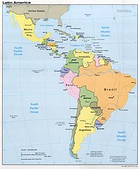
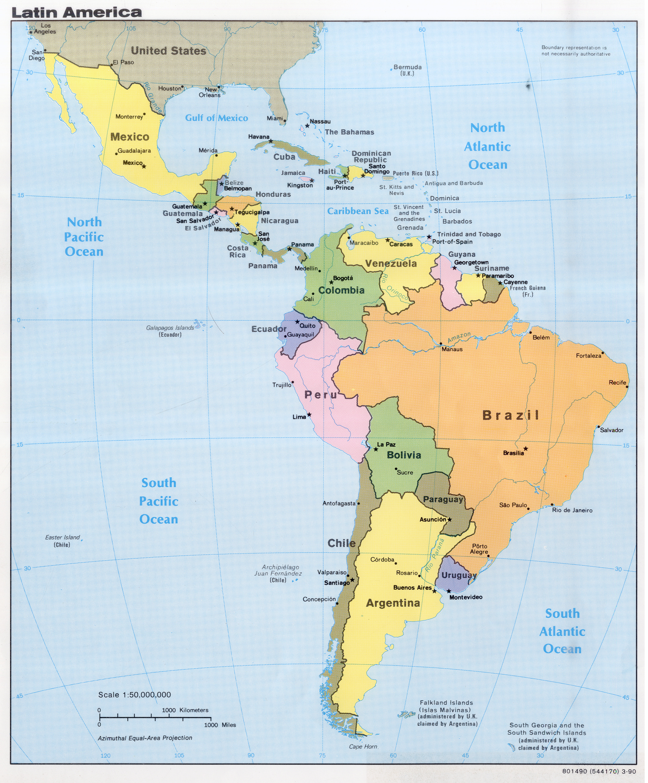
File:Latin America, 1990.jpg

Size of this preview: 496 × 600 pixels. Other resolutions: 198 × 240 pixels | 397 × 480 pixels | 635 × 768 pixels | 847 × 1,024 pixels | 2,175 × 2,630 pixels.
Original file (2,175 × 2,630 pixels, file size: 5.79 MB, MIME type: image/jpeg)
Captions
Captions
Add a one-line explanation of what this file represents
Summary edit
| Description |
Español: Mapa político de Latinoamérica, producido por la CIA en 1990
English: Political map of Latin America, produced by CIA in 1990 |
| Date | |
| Source | https://maps.lib.utexas.edu/maps/americas/latin_america_1990.jpg |
| Author | Central Intelligence Agency (CIA) |
Licensing edit
| This image is a work of a Central Intelligence Agency employee, taken or made as part of that person's official duties. As a Work of the United States Government, this image or media is in the public domain in the United States.
|

|
File history
Click on a date/time to view the file as it appeared at that time.
| Date/Time | Thumbnail | Dimensions | User | Comment | |
|---|---|---|---|---|---|
| current | 18:28, 3 December 2021 | | 2,175 × 2,630 (5.79 MB) | Universalis (talk | contribs) | Uploaded a work by Central Intelligence Agency (CIA) from https://maps.lib.utexas.edu/maps/americas/latin_america_1990.jpg with UploadWizard |
You cannot overwrite this file.
File usage on Commons
There are no pages that use this file.