File:Latitude (PSF).png
Size of this preview: 578 × 600 pixels. Other resolutions: 231 × 240 pixels | 462 × 480 pixels | 740 × 768 pixels | 1,104 × 1,146 pixels.
Original file (1,104 × 1,146 pixels, file size: 404 KB, MIME type: image/png)
Captions
Captions
Add a one-line explanation of what this file represents
| Description |
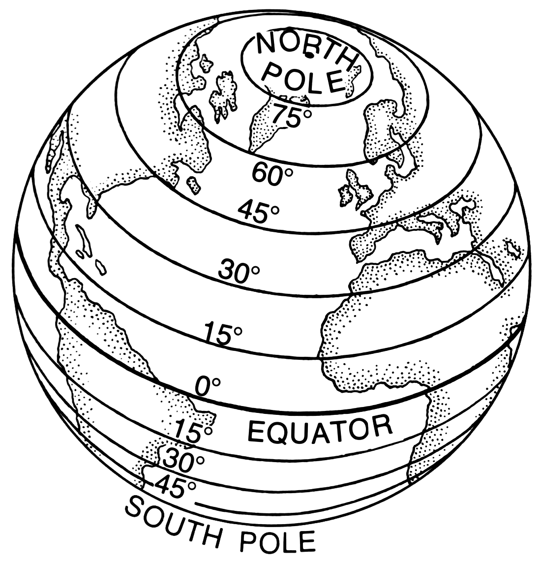
English: Line art drawing of Earth with latitdue parallels latitudes.
Suomi: Piirustus Maapallosta, johon on merkitty pituuspiirit. |
|||
| Source | Archives of Pearson Scott Foresman, donated to the Wikimedia Foundation | |||
| Author | Pearson Scott Foresman | |||
| Permission (Reusing this file) |
|
|||
| Other versions |
|


nbgsdfl
File history
Click on a date/time to view the file as it appeared at that time.
| Date/Time | Thumbnail | Dimensions | User | Comment | |
|---|---|---|---|---|---|
| current | 12:25, 6 March 2021 | | 1,104 × 1,146 (404 KB) | Encik Tekateki (talk | contribs) | compress smaller |
| 12:15, 6 March 2021 |  | 2,208 × 2,292 (1.25 MB) | Encik Tekateki (talk | contribs) | Transparent layout | |
| 18:44, 6 December 2007 |  | 2,618 × 2,712 (537 KB) | Igno2 (talk | contribs) | {{ScottForesman |description= {{en|Line art drawing of Earth with latitudes.}} {{fi|Piirustus Maapallosta, johon on merkitty pituuspiirit. |raw=PSF_L-520004.png |other versions= }} Category:Line art [[Category |
You cannot overwrite this file.
File usage on Commons
The following 6 pages use this file:
.png)
File usage on other wikis
The following other wikis use this file:
- Usage on af.wikipedia.org
- Usage on ar.wikipedia.org
- Usage on bo.wikipedia.org
- Usage on cv.wikipedia.org
- Usage on de.wikipedia.org
- Usage on de.wiktionary.org
- Usage on dsb.wikipedia.org
- Usage on eo.wikipedia.org
- Usage on es.wikipedia.org
- Usage on es.wikibooks.org
- Usage on et.wikipedia.org
- Usage on fa.wikipedia.org
- Usage on gl.wikipedia.org
- Usage on gl.wiktionary.org
- Usage on hsb.wikipedia.org
- Usage on hy.wikipedia.org
- Usage on id.wikipedia.org
- Usage on it.wikipedia.org
- Usage on it.wikibooks.org
- Usage on it.wikiversity.org
- Usage on lb.wikipedia.org
- Usage on li.wiktionary.org
- Usage on lmo.wiktionary.org
- Usage on mn.wikipedia.org
- Usage on nn.wikipedia.org
- Usage on pnb.wikipedia.org
- Usage on pnb.wiktionary.org
- Usage on sd.wiktionary.org
- Usage on sl.wikipedia.org
- Usage on sq.wikibooks.org
- Usage on sr.wikipedia.org
- Usage on sw.wiktionary.org
- Usage on szl.wikipedia.org
- Usage on yi.wikipedia.org
.png&oldid=840039819)