File:Leigh Smith 1880 expedition map.tif

Original file (4,275 × 3,657 pixels, file size: 15.04 MB, MIME type: image/tiff)
Captions
Captions
Summary
edit| Description |
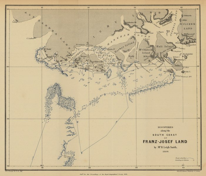
English: Route, direction, and dates of voyage are shown.
Ice sheets and icebergs along route shown in blue. Depth shown by soundings. Relief shown by hachures. Conjectural coastlines shown by broken lines. Site of abandonment of Tegetthoff [Austrian vessel] in 1874 is shown. Scale: ca. 1 : 9 200 000 From: Proceedings of the Royal Geographical Society and monthly record of geography. Vol. 3 (1881), no. 3, pp. 129-50 |
| Date | |
| Source | Maps and Geospatial Data, Princeton University Library |
| Author | William John Turner |
Licensing
edit|
This work is in the public domain in its country of origin and other countries and areas where the copyright term is the author's life plus 70 years or fewer. This work is in the public domain in the United States because it was published (or registered with the U.S. Copyright Office) before January 1, 1929. | |
| This file has been identified as being free of known restrictions under copyright law, including all related and neighboring rights. | |
File history
Click on a date/time to view the file as it appeared at that time.
| Date/Time | Thumbnail | Dimensions | User | Comment | |
|---|---|---|---|---|---|
| current | 00:33, 11 January 2021 |  | 4,275 × 3,657 (15.04 MB) | Kaschelott (talk | contribs) | Uploaded a work by William John Turner from https://maps.princeton.edu/catalog/princeton-02870z378 with UploadWizard |
You cannot overwrite this file.
File usage on Commons
There are no pages that use this file.
File usage on other wikis
The following other wikis use this file:
- Usage on ca.wikipedia.org
- Usage on en.wikipedia.org
- Usage on es.wikipedia.org
- Usage on ru.wikipedia.org
- Usage on sv.wikipedia.org