File:Liji Waterway Intake Pumping Station Remains.jpg
Size of this preview: 800 × 600 pixels. Other resolutions: 320 × 240 pixels | 640 × 480 pixels | 1,024 × 768 pixels | 1,280 × 960 pixels | 2,560 × 1,920 pixels | 5,248 × 3,936 pixels.
Original file (5,248 × 3,936 pixels, file size: 8.9 MB, MIME type: image/jpeg)
Captions
Captions
Add a one-line explanation of what this file represents
Summary
edit
| Description |
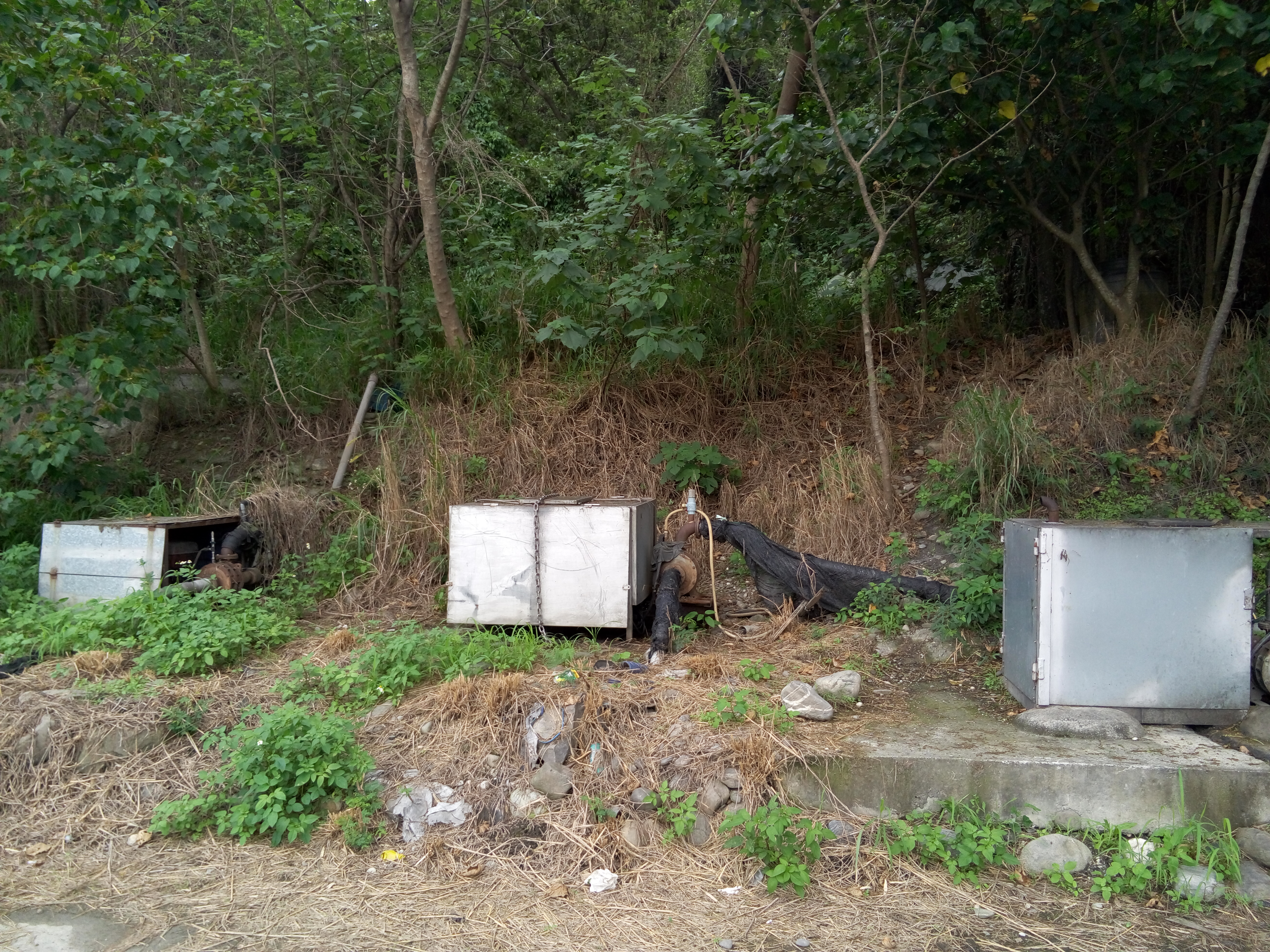
中文(臺灣):中華民國(臺灣)臺東縣卑南鄉,已荒廢約30年的利吉圳圳頭抽水站
由於利吉圳原灌區位於取水來源卑南溪的河階地,海拔高度高於卑南溪河床,故無法使用正常的閘門進水口或是自由引流方式取水而興建抽水站取水,此抽水站即為利吉圳之進水口。 因抽水需要電力,而電力費用由當地使用該水圳之居民共同負擔,但因負擔過重最終在利吉圳興建完成數個月後,放棄使用而廢棄至今。中文(中国大陆):中华民国(台湾)台东县卑南乡,已荒废约30年的利吉圳圳头抽水站
由于利吉圳原灌区位于取水来源卑南溪的河阶地,海拔高度高于卑南溪河床,故无法使用正常的闸门进水口或是自由引流方式取水而兴建抽水站取水,此抽水站即为利吉圳之进水口。 因抽水需要电力,而电力费用由当地使用该水圳之居民共同负担,但因负担过重最终在利吉圳兴建完成数个月后,放弃使用而废弃至今。English: Liji Waterway Intake Pumping Station Remains.
Because Liji Waterway original irrigation water source located Beinan River river terraces, altitude higher than Beinan River riverbed, it can not use the normal intake gate way or the freedom of water and the construction of drainage water pumping station, the pumping station shall be Liji Waterway 's intake. Because the pumping power required, while electricity costs are born by the local residents of the waterway's use, but overburdened in Liji Chun final few months after the completion of the construction, use and abandon obsolete today. |
| Date | |
| Source | Own work |
| Author | Eric Deng |
| Camera location | | View this and other nearby images on: OpenStreetMap |
|---|
Licensing
edit
I, the copyright holder of this work, hereby publish it under the following license:
This file is licensed under the Creative Commons Attribution-Share Alike 4.0 International license.
- You are free:
- to share – to copy, distribute and transmit the work
- to remix – to adapt the work
- Under the following conditions:
- attribution – You must give appropriate credit, provide a link to the license, and indicate if changes were made. You may do so in any reasonable manner, but not in any way that suggests the licensor endorses you or your use.
- share alike – If you remix, transform, or build upon the material, you must distribute your contributions under the same or compatible license as the original.
File history
Click on a date/time to view the file as it appeared at that time.
| Date/Time | Thumbnail | Dimensions | User | Comment | |
|---|---|---|---|---|---|
| current | 15:10, 7 April 2015 | | 5,248 × 3,936 (8.9 MB) | Matt8830 (talk | contribs) | User created page with UploadWizard |
You cannot overwrite this file.
File usage on Commons
There are no pages that use this file.