File:Lime Rock Park.png
No higher resolution available.
Lime_Rock_Park.png (620 × 415 pixels, file size: 69 KB, MIME type: image/png)
Captions
Captions
Add a one-line explanation of what this file represents
Summary
edit
| Description | Version of Lime Rock Park.svg for use with browsers like IE7 that don't support SVG. |
| Date | |
| Source | Own work |
| Author | Will Pittenger |
| Other versions |
 |
| Camera location | | View this and other nearby images on: OpenStreetMap |
|---|
Licensing
edit
| I, the copyright holder of this work, release this work into the public domain. This applies worldwide. In some countries this may not be legally possible; if so: I grant anyone the right to use this work for any purpose, without any conditions, unless such conditions are required by law. |
File history
Click on a date/time to view the file as it appeared at that time.
| Date/Time | Thumbnail | Dimensions | User | Comment | |
|---|---|---|---|---|---|
| current | 23:55, 17 July 2008 | | 620 × 415 (69 KB) | Will Pittenger (talk | contribs) | Still another version that rms old name |
| 23:53, 17 July 2008 |  | 620 × 415 (74 KB) | Will Pittenger (talk | contribs) | New version with updates (accuracy for this version is unknown as [[]]w:Google Earth]] doesn't show the changes yet) | |
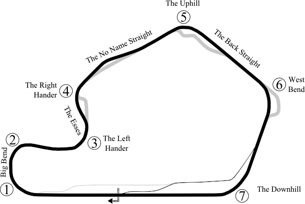
| 07:25, 27 May 2008 |  | 632 × 414 (42 KB) | Will Pittenger (talk | contribs) | Added start/finish line, direction of track, turn names, name of the chicane, and straight names. | |
| 06:42, 27 May 2008 |  | 581 × 391 (24 KB) | Will Pittenger (talk | contribs) | {{Information |Description=Version of Image:Lime Rock Park.svg for use with browsers like IE7 that don't support SVG. |Source=self-made |Date=5-27-2008 |Author= Will Pittenger |Permission= |other_versions=[[:Image:Lime Rock P |
You cannot overwrite this file.
File usage on Commons
The following page uses this file:
File usage on other wikis
The following other wikis use this file:
- Usage on de.wikipedia.org
- Usage on en.wikipedia.org
- Usage on fa.wikipedia.org
- Usage on fr.wikipedia.org