File:Limestone quarry - geograph.org.uk - 1102946.jpg
Size of this preview: 450 × 600 pixels. Other resolutions: 180 × 240 pixels | 480 × 640 pixels.
Original file (480 × 640 pixels, file size: 89 KB, MIME type: image/jpeg)
Captions
Captions
Add a one-line explanation of what this file represents
Summary
edit
| Description |
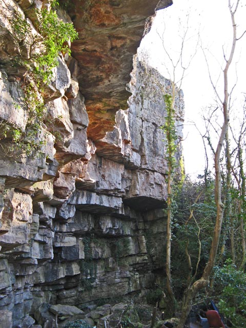
English: Limestone quarry The minor road follows the strike of the beds of Carboniferous limestone along an escarpment formed by the dipping beds. The outcrop is quarried for about a half kilometre, although long disused judging from the age of trees growing near and from the face. The outcrop is very well bedded in a very compact and unfossiliferous formation, and was probably used for building stone rather than lime or crushed rock. |
| Date | |
| Source | From geograph.org.uk |
| Author | Jonathan Wilkins |
| Attribution (required by the license) | Jonathan Wilkins / Limestone quarry / |
| Camera location | | View this and other nearby images on: OpenStreetMap |
|---|
_heading:135.00&language=en)
| Object location | | View this and other nearby images on: OpenStreetMap |
|---|
_heading:135.00&language=en)
Licensing
edit

|
This image was taken from the Geograph project collection. See this photograph's page on the Geograph website for the photographer's contact details. The copyright on this image is owned by Jonathan Wilkins and is licensed for reuse under the Creative Commons Attribution-ShareAlike 2.0 license.
|
This file is licensed under the Creative Commons Attribution-Share Alike 2.0 Generic license.
Attribution: Jonathan Wilkins
- You are free:
- to share – to copy, distribute and transmit the work
- to remix – to adapt the work
- Under the following conditions:
- attribution – You must give appropriate credit, provide a link to the license, and indicate if changes were made. You may do so in any reasonable manner, but not in any way that suggests the licensor endorses you or your use.
- share alike – If you remix, transform, or build upon the material, you must distribute your contributions under the same or compatible license as the original.

|
The categories of this image need checking. You can do so here.
|
File history
Click on a date/time to view the file as it appeared at that time.
| Date/Time | Thumbnail | Dimensions | User | Comment | |
|---|---|---|---|---|---|
| current | 18:04, 24 February 2011 | | 480 × 640 (89 KB) | GeographBot (talk | contribs) | == {{int:filedesc}} == {{Information |description={{en|1=Limestone quarry The minor road follows the strike of the beds of Carboniferous limestone along an escarpment formed by the dipping beds. The outcrop is quarried for about a half kilometre, although |
You cannot overwrite this file.
File usage on Commons
There are no pages that use this file.