File:Limyra 5220.jpg
Size of this preview: 800 × 533 pixels. Other resolutions: 320 × 213 pixels | 640 × 426 pixels | 1,024 × 682 pixels | 1,280 × 852 pixels | 1,600 × 1,065 pixels.
Original file (1,600 × 1,065 pixels, file size: 522 KB, MIME type: image/jpeg)
Captions
Captions
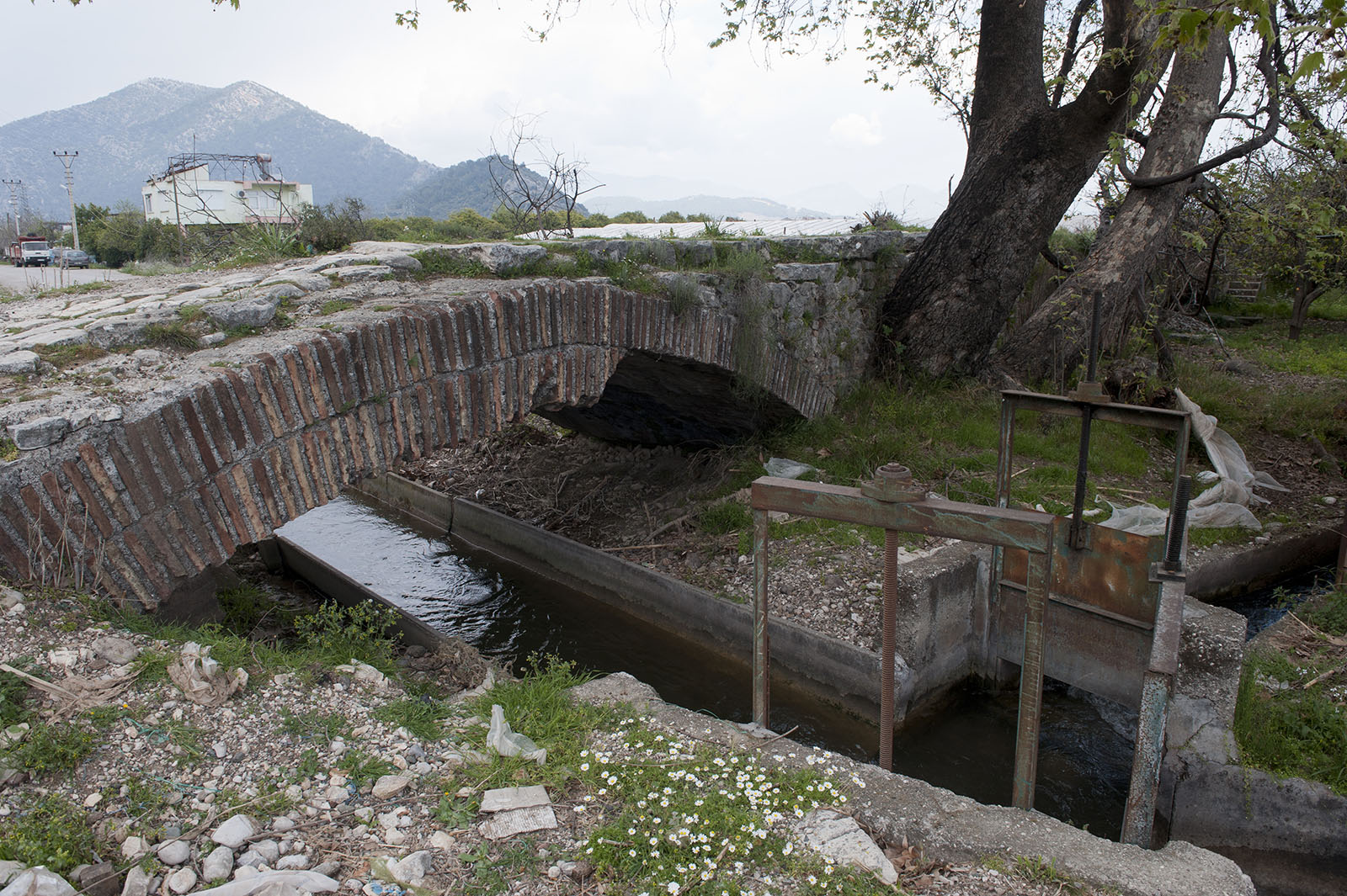
Limyra Roman Bridge
Summary
edit
| Description |
English: It does not quite feel like a bridge, more like an elevated road, but then again, the terrain must have been very different here in Roman times. The Wikipedia has about this bridge: "The Limyra Bridge (in Turkish: Kırk Göz Kemeri, "Bridge of the Forty Arches") is a late Roman bridge in Lycia, in modern south-west Turkey, and one of the oldest segmented arch bridges in the world. The 360 m (1,181.1 ft) long bridge is located near the ancient city of Limyra, and spans the Alakır Çayı river over 26 segmental arches. These arches, with a span-to-rise ratio of 5.3:1, give the bridge an unusually flat profile, and were unsurpassed as an architectural achievement until the late Middle Ages. Despite its unique features, the bridge remains relatively unknown, and only in the 1970s did researchers from the Istanbul branch of the German Archaeological Institute carry out field examinations on the site." |
| Date | |
| Source | Own work |
| Author | Dosseman |
| Camera location | | View this and other nearby images on: OpenStreetMap |
|---|
Licensing
edit
I, the copyright holder of this work, hereby publish it under the following license:
This file is licensed under the Creative Commons Attribution-Share Alike 4.0 International license.
- You are free:
- to share – to copy, distribute and transmit the work
- to remix – to adapt the work
- Under the following conditions:
- attribution – You must give appropriate credit, provide a link to the license, and indicate if changes were made. You may do so in any reasonable manner, but not in any way that suggests the licensor endorses you or your use.
- share alike – If you remix, transform, or build upon the material, you must distribute your contributions under the same or compatible license as the original.
File history
Click on a date/time to view the file as it appeared at that time.
| Date/Time | Thumbnail | Dimensions | User | Comment | |
|---|---|---|---|---|---|
| current | 10:17, 10 March 2019 | | 1,600 × 1,065 (522 KB) | Dosseman (talk | contribs) | User created page with UploadWizard |
You cannot overwrite this file.
File usage on Commons
There are no pages that use this file.
File usage on other wikis
The following other wikis use this file:
- Usage on el.wikipedia.org
- Usage on en.wikipedia.org
- Usage on es.wikipedia.org
- Usage on tr.wikipedia.org