File:Lipsk (gmina) location map.png
Size of this preview: 766 × 600 pixels. Other resolutions: 307 × 240 pixels | 613 × 480 pixels | 981 × 768 pixels | 1,149 × 900 pixels.
Original file (1,149 × 900 pixels, file size: 221 KB, MIME type: image/png)
Captions
Captions
Add a one-line explanation of what this file represents
| Description |
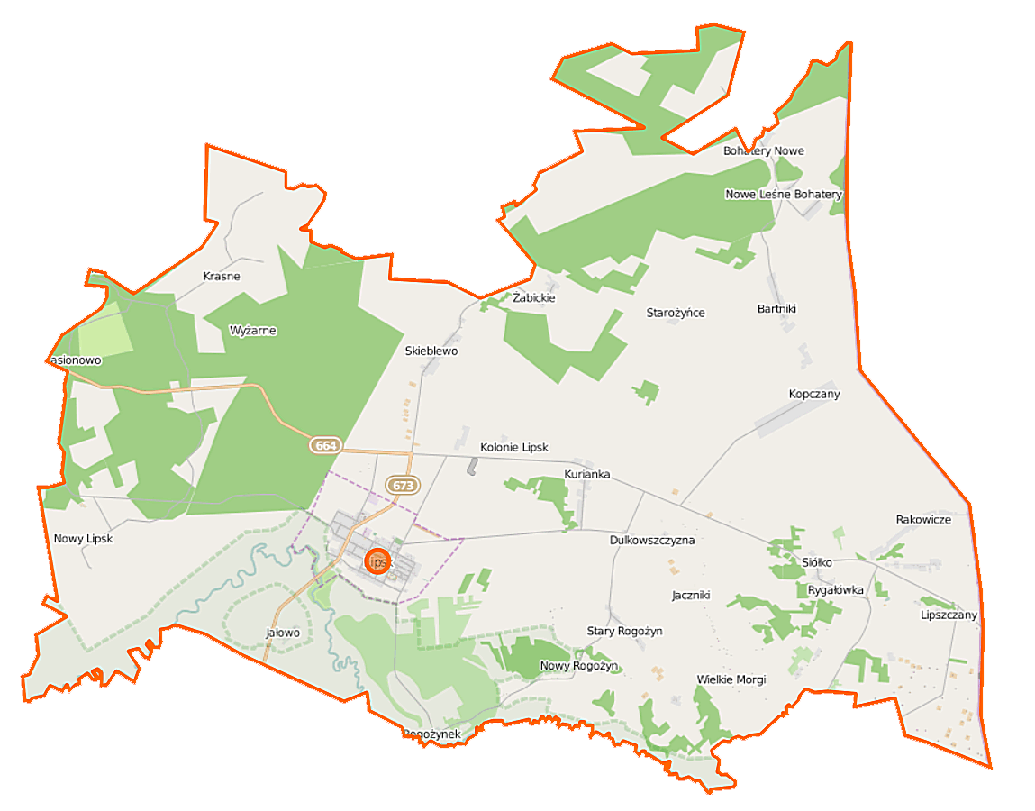
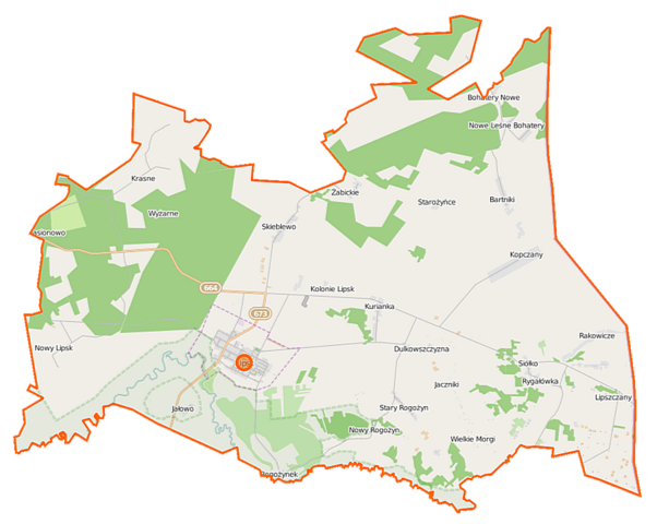
Polski: Mapa gminy Lipsk, Polska
English: Map of Gmina Lipsk, Poland |
|||||||||
| Date | ||||||||||
| Source | You may find a page on the OpenStreetMap wiki page for Lipsk (gmina) | |||||||||
| Creator |
OpenStreetMap contributors OpenStreetMap contributors |
|||||||||
| Permission (Reusing this file) |
OpenStreetMap data is available under the Open Database License (details). Map tiles are licensed under the Creative Commons Attribution-ShareAlike 2.0 license (CC-BY-SA 2.0).
This file is licensed under the Creative Commons Attribution-Share Alike 2.0 Generic license.
|
|||||||||
| Geotemporal data | ||||||||||
| Bounding box |
|
|||||||||
| Georeferencing | If inappropriate please set warp_status = skip to hide. | |||||||||
File history
Click on a date/time to view the file as it appeared at that time.
| Date/Time | Thumbnail | Dimensions | User | Comment | |
|---|---|---|---|---|---|
| current | 12:55, 18 September 2014 | | 1,149 × 900 (221 KB) | VanWiel (talk | contribs) | |
| 07:42, 3 June 2014 |  | 1,000 × 782 (360 KB) | VanWiel (talk | contribs) | {{OpenStreetMap | name = Lipsk (gmina) | location = Lipsk (gmina) | description = {{pl|Mapa gminy Lipsk, Polska}} {{en|Map of Gmina Lipsk, Poland}} | top = 53.8338 | left = 23.2868 | right... |
You cannot overwrite this file.
File usage on Commons
The following page uses this file:
- File:Lipsk (gmina) lication map.png (file redirect)
_lication_map.png&redirect=no)
File usage on other wikis
The following other wikis use this file:
- Usage on id.wikipedia.org
- Usage on pl.wikipedia.org
- Lipsk (Polska)
- Lipsk (gmina)
- Dolinczany
- Dulkowszczyzna
- Jaczniki
- Kurianka
- Kolonie Lipsk
- Kopczany
- Lichosielce
- Lipszczany
- Lubinowo (gmina Lipsk)
- Nowe Leśne Bohatery
- Nowy Lipsk
- Nowy Rogożyn
- Podwołkuszne
- Rogożynek
- Rygałówka
- Siółko
- Skieblewo
- Stary Rogożyn
- Stare Leśne Bohatery
- Starożyńce
- Wołkusz
- Wyżarne
- Żabickie
- Bartniki (województwo podlaskie)
- Jałowo (powiat augustowski)
- Krasne (powiat augustowski)
- Rakowicze (powiat augustowski)
- Jasionowo (gmina Lipsk)
- Lipsk Murowany
- Sołojewszczyzna
- Parafia Matki Bożej Anielskiej w Lipsku
- Cmentarz żydowski w Lipsku (powiat augustowski)
- Cerkiew Narodzenia Najświętszej Marii Panny w Lipsku
- Kościół Matki Bożej Anielskiej w Lipsku
- Muzeum Regionalne w Lipsku
- Placówka Straży Granicznej w Lipsku
- Przedsiębiorstwo Produkcyjne „Unitra-Lipsk”
- Moduł:Mapa/dane/Lipsk
- Moduł:Mapa/dane/Lipsk (gmina)
- Parafia Przemienienia Pańskiego w Rygałówce
- Usage on pl.wikibooks.org
- Usage on www.wikidata.org
_location_map.png&oldid=519974697)