File:Lister og Mandals amt nr 9- Situations Cart af Christiansand med underligende Fortter, 1730.jpg

Size of this preview: 786 × 600 pixels. Other resolutions: 315 × 240 pixels | 629 × 480 pixels | 1,006 × 768 pixels | 1,280 × 977 pixels | 2,560 × 1,954 pixels | 9,450 × 7,213 pixels.
Original file (9,450 × 7,213 pixels, file size: 6.7 MB, MIME type: image/jpeg)
Captions
Captions
Add a one-line explanation of what this file represents
Summary edit
| Title |
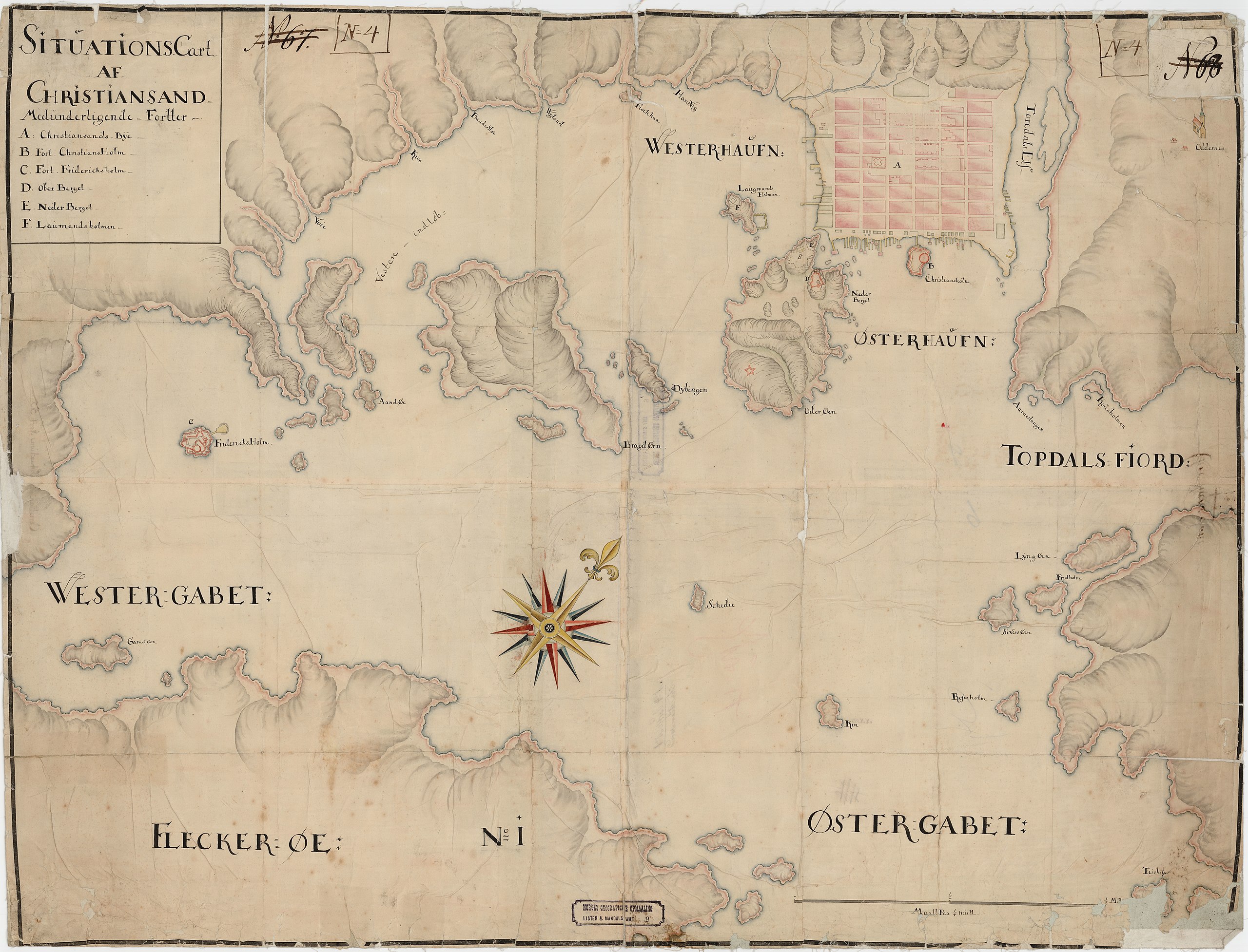
Norsk bokmål: Lister og Mandals amt nr 9: Situations Cart af Christiansand med underligende Fortter, 1730 |
||||||||||||||||||||||||||
| Description |
Norsk bokmål: Situations Cart af Christianssand med underliggende Forter. |
||||||||||||||||||||||||||
| Date | |||||||||||||||||||||||||||
| Source |
|
||||||||||||||||||||||||||
| Permission (Reusing this file) |
This file is licensed under the Creative Commons Attribution 4.0 International license.
|
||||||||||||||||||||||||||
| Geotemporal data | |||||||||||||||||||||||||||
| Date depicted | |||||||||||||||||||||||||||
| Map location | Vest-Agder,Kristiansand (Vest-Agder,Kristiansand) | ||||||||||||||||||||||||||
| Scale | 1:10,000 | ||||||||||||||||||||||||||
| Georeferencing | If inappropriate please set warp_status = skip to hide. | ||||||||||||||||||||||||||
| Bibliographic data | |||||||||||||||||||||||||||
| Part of the series | Category:Lista and Mandal county | ||||||||||||||||||||||||||
| Map sheet | 9 | ||||||||||||||||||||||||||
| Language | Norwegian | ||||||||||||||||||||||||||
| Archival data | |||||||||||||||||||||||||||
| Collection |
|
||||||||||||||||||||||||||
| Accession number | |||||||||||||||||||||||||||
| Medium | drawing | ||||||||||||||||||||||||||
File history
Click on a date/time to view the file as it appeared at that time.
| Date/Time | Thumbnail | Dimensions | User | Comment | |
|---|---|---|---|---|---|
| current | 11:38, 31 October 2015 | | 9,450 × 7,213 (6.7 MB) | Artturimatias (talk | contribs) | GWToolset: Creating mediafile for Artturimatias. |
You cannot overwrite this file.
File usage on Commons
There are no pages that use this file.