File:Littleriver4.jpg

Size of this preview: 798 × 599 pixels. Other resolutions: 320 × 240 pixels | 639 × 480 pixels | 1,023 × 768 pixels | 1,280 × 961 pixels | 2,041 × 1,533 pixels.
Original file (2,041 × 1,533 pixels, file size: 1.25 MB, MIME type: image/jpeg)
Captions
Captions
Add a one-line explanation of what this file represents
Summary edit
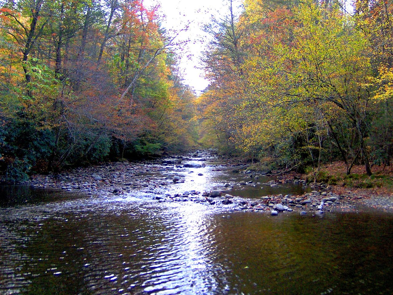
| Description | Little River in Elkmont, Tennessee, GSMNP. The Elkmont area is created by the confluence of Little River and Jakes Creek, which have sliced a small valley between Sugarland Mountain and Meigs Mountain. | ||||||||
| Date | |||||||||
| Source | Own work | ||||||||
| Author | Brian Stansberry | ||||||||
| Permission (Reusing this file) |
I, Brian Stansberry, the copyright holder of this work, hereby publishes it under the following licenses:
This file is licensed under the Creative Commons Attribution 2.5 Generic license. Attribution: I, Brian Stansberry
You may select the license of your choice. |

File history
Click on a date/time to view the file as it appeared at that time.
| Date/Time | Thumbnail | Dimensions | User | Comment | |
|---|---|---|---|---|---|
| current | 20:43, 24 February 2010 | | 2,041 × 1,533 (1.25 MB) | BrineStans (talk | contribs) | sharpen |
| 17:46, 29 October 2007 |  | 2,041 × 1,533 (1.02 MB) | BrineStans (talk | contribs) | {{Information |Description=Little River in Elkmont, Tennessee, GSMNP. The Elkmont area is created by the confluence of Little River and Jakes Creek, which have sliced a small valley between Sugarland Mountain and Meigs Mountain. |Source=self-made |Date=1 | |
| 20:55, 14 August 2007 |  | 1,198 × 818 (312 KB) | BrineStans (talk | contribs) | {{Information |Description=Little River in Elkmont, GSMNP, in East Tennessee. From its source on the slopes of Clingman's Dome and Mount Collins, the river absorbs Fish Camp Prong, Rough Creek, and Jakes Creek before slicing through Elkmont and turning n |
You cannot overwrite this file.
File usage on Commons
There are no pages that use this file.
File usage on other wikis
The following other wikis use this file:
- Usage on en.wikipedia.org