File:Loa and Kea trends.svg

Size of this PNG preview of this SVG file: 527 × 600 pixels. Other resolutions: 211 × 240 pixels | 422 × 480 pixels | 675 × 768 pixels | 900 × 1,024 pixels | 1,800 × 2,048 pixels | 1,417 × 1,612 pixels.
Original file (SVG file, nominally 1,417 × 1,612 pixels, file size: 322 KB)
Captions
Captions
Add a one-line explanation of what this file represents
Summary
edit
| Description |
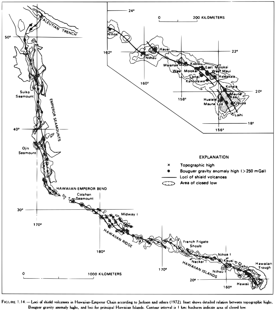
English: Map showing the geologic echelon loci "trends" of the "Kea" and "Loa" Hawaiian volcanoes. |
| Date | |
| Source | http://pubs.usgs.gov/pp/1987/1350/pp1350_vol1.pdf |
| Author | USGS |
| Other versions | File:Loa and Kea trends.png |
| SVG development |
Licensing
edit
This image is in the public domain in the United States because it only contains materials that originally came from the United States Geological Survey, an agency of the United States Department of the Interior. For more information, see the official USGS copyright policy.
|
File history
Click on a date/time to view the file as it appeared at that time.
| Date/Time | Thumbnail | Dimensions | User | Comment | |
|---|---|---|---|---|---|
| current | 22:31, 30 June 2010 | | 1,417 × 1,612 (322 KB) | DieBuche (talk | contribs) | Try to fix SVG using scour |
| 20:15, 14 June 2009 |  | 1,417 × 1,612 (705 KB) | ErgoSum88~commonswiki (talk | contribs) | modified version | |
| 19:45, 14 June 2009 |  | 1,417 × 1,612 (743 KB) | ErgoSum88~commonswiki (talk | contribs) | {{Information |Description={{en|1=Map showing the geologic echelon loci "trends" of the "Kea" and "Loa" Hawaiian volcanoes.}} |Source=http://pubs.usgs.gov/pp/1987/1350/pp1350_vol1.pdf |Author=USGS |Date=1987 |Permission=see below |other_versions=[[:file:L |
You cannot overwrite this file.
File usage on Commons
The following page uses this file:
File usage on other wikis
The following other wikis use this file:
- Usage on de.wikipedia.org
- Usage on en.wikipedia.org