File:Locatie Brittanniëhaven.png
No higher resolution available.
Locatie_Brittanniëhaven.png (798 × 376 pixels, file size: 15 KB, MIME type: image/png)
Captions
Captions
Add a one-line explanation of what this file represents
| Description |
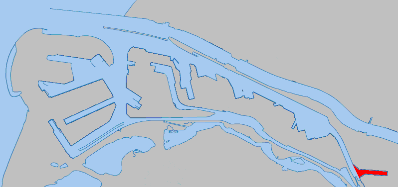
Nederlands: Een kaart die de locatie aangeeft van de bovenstaande haven in het Rotterdamse havengebied.
English: A map indicating the location of the above harbour in the Rotterdam harbour area. |
| Date | |
| Source | nl:Image:Locatie Brittanniëhaven.png |
| Author | Hanhil |
| Permission (Reusing this file) |
Own work, all rights released (Public domain) |
| I, the copyright holder of this work, release this work into the public domain. This applies worldwide. In some countries this may not be legally possible; if so: I grant anyone the right to use this work for any purpose, without any conditions, unless such conditions are required by law. |
File history
Click on a date/time to view the file as it appeared at that time.
| Date/Time | Thumbnail | Dimensions | User | Comment | |
|---|---|---|---|---|---|
| current | 16:03, 24 January 2007 | | 798 × 376 (15 KB) | Siebrand (talk | contribs) | {{Information |Description={{nl|Een kaart die de locatie aangeeft van de bovenstaande haven in het Rotterdamse havengebied.}} {{en|A map indicating the location of the above harbour in the Rotterdam harbour area.}} |Source=[[:nl:Image:{{PAGENAME}}]] |Date |
You cannot overwrite this file.
File usage on Commons
The following page uses this file:
File usage on other wikis
The following other wikis use this file:
- Usage on nl.wikipedia.org
- Usage on www.wikidata.org