File:LocationMap-MarsCuriosityRover-Sol1705-20170522.jpg

Original file (4,800 × 3,600 pixels, file size: 3.05 MB, MIME type: image/jpeg)
Captions
Captions
Summary edit
| Description |
English: 05.22.2017
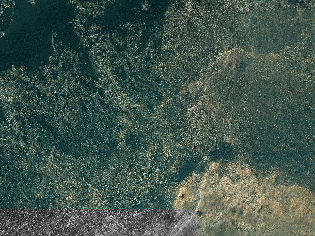
Curiosity Rover's Location for Sol 1705 https://mars.jpl.nasa.gov/multimedia/images/2017/curiosity-rovers-location-for-sol-1705 This map shows the route driven by NASA's Mars rover Curiosity through the 1705 Martian day, or sol, of the rover's mission on Mars (May 22, 2017). Numbering of the dots along the line indicate the sol number of each drive. North is up. From Sol 1703 to Sol 1705, Curiosity had driven a straight line distance of about 23.43 feet (7.14 meters). Since touching down in Bradbury Landing in August 2012, Curiosity has driven 10.25 miles (16.50 kilometers). The base image from the map is from the High Resolution Imaging Science Experiment Camera (HiRISE) in NASA's Mars Reconnaissance Orbiter. |
| Date | |
| Source | https://mars.jpl.nasa.gov/imgs/2017/05/Curiosity_Location_Sol1705-full.jpg |
| Author | https://mars.jpl.nasa.gov/imgs/2017/05/Curiosity_Location_Sol1705-full.jpg |
Licensing edit
| This file is in the public domain in the United States because it was solely created by NASA. NASA copyright policy states that "NASA material is not protected by copyright unless noted". (See Template:PD-USGov, NASA copyright policy page or JPL Image Use Policy.) | ||
 |
Warnings:
|
File history
Click on a date/time to view the file as it appeared at that time.
| Date/Time | Thumbnail | Dimensions | User | Comment | |
|---|---|---|---|---|---|
| current | 01:17, 27 May 2017 | | 4,800 × 3,600 (3.05 MB) | Drbogdan (talk | contribs) | User created page with UploadWizard |
You cannot overwrite this file.
File usage on Commons
The following page uses this file:
File usage on other wikis
The following other wikis use this file:
- Usage on fi.wikipedia.org
- Usage on tr.wikipedia.org