File:Location Fernando de Noronha.png
No higher resolution available.
Location_Fernando_de_Noronha.png (435 × 275 pixels, file size: 9 KB, MIME type: image/png)
Captions
Captions
Add a one-line explanation of what this file represents
Summary
edit
| Description |
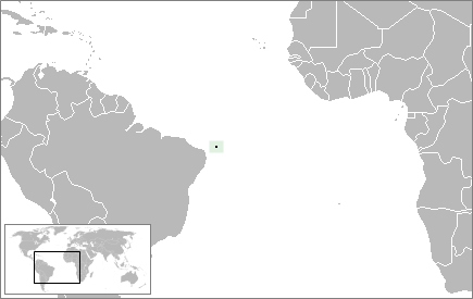
English: Location map of the Fernando de Noronha Archipelago.
Português: Mapa de localização do Arquipélago de Fernando de Noronha. |
| Date | |
| Source | Image:BlankMap-World.png |
| Author | Limongi |
Licensing
edit
| I, the copyright holder of this work, release this work into the public domain. This applies worldwide. In some countries this may not be legally possible; if so: I grant anyone the right to use this work for any purpose, without any conditions, unless such conditions are required by law. |
File history
Click on a date/time to view the file as it appeared at that time.
| Date/Time | Thumbnail | Dimensions | User | Comment | |
|---|---|---|---|---|---|
| current | 20:52, 6 June 2009 | | 435 × 275 (9 KB) | Limongi (talk | contribs) | {{Information |Description={{en|1=Location map of the Fernando de Noronha Archipelago.}} {{pt-br|1=Mapa de localização do Arquipélago de Fernando de Noronha.}} |Source= |
You cannot overwrite this file.
File usage on Commons
There are no pages that use this file.
File usage on other wikis
The following other wikis use this file:
- Usage on als.wikipedia.org
- Usage on de.wikipedia.org
- Usage on en.wikipedia.org
- Usage on eo.wikipedia.org
- Usage on es.wikipedia.org
- Usage on gl.wikipedia.org
- Usage on lv.wikipedia.org
- Usage on mt.wikipedia.org
- Usage on ro.wikipedia.org
- Usage on vi.wikipedia.org
- Usage on zh.wikipedia.org