File:Location Mauves-sur-Loire.svg

Size of this PNG preview of this SVG file: 400 × 320 pixels. Other resolutions: 300 × 240 pixels | 600 × 480 pixels | 960 × 768 pixels | 1,280 × 1,024 pixels | 2,560 × 2,048 pixels.
Original file (SVG file, nominally 400 × 320 pixels, file size: 12 KB)
Captions
Captions
Add a one-line explanation of what this file represents
Summary edit
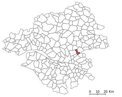
| Description | Locator map for the commune of Mauves-sur-Loire inside the french département of Loire-Atlantique |
| Date | |
| Source | Own work based on: File:Loire-Atlantique urban areas.svg |
| Author |
User:Poulpy, from an image by Utilisateur:Zot Fixed & optimized by User:ReneeWrites |
| Permission (Reusing this file) |
GNU General Public License |
| SVG development | This locator map was created with an unknown SVG tool. |
Licensing edit

|
This work is free software; you can redistribute it and/or modify it under the terms of the GNU General Public License as published by the Free Software Foundation; either version 2 of the License, or any later version. This work is distributed in the hope that it will be useful, but without any warranty; without even the implied warranty of merchantability or fitness for a particular purpose. See version 2 and version 3 of the GNU General Public License for more details. |
File history
Click on a date/time to view the file as it appeared at that time.
| Date/Time | Thumbnail | Dimensions | User | Comment | |
|---|---|---|---|---|---|
| current | 18:40, 29 July 2023 | | 400 × 320 (12 KB) | ReneeWrites (talk | contribs) | Fixed SVG error, smaller file size |
| 14:50, 19 June 2006 |  | 400 × 320 (25 KB) | Poulpy (talk | contribs) | {{Information |Description=Locator map for the commune of Mauves-sur-Loire inside the french département of Loire-Atlantique |Source=Own work, based on Image:Loire-Atlantique urban areas.svg |Date=06/19/2006 |Author=fr:User:Poulpy, from an imag |
You cannot overwrite this file.
File usage on Commons
There are no pages that use this file.
File usage on other wikis
The following other wikis use this file:
- Usage on ca.wikipedia.org
- Usage on ceb.wikipedia.org
- Usage on fr.wikipedia.org