File:Location of Alagirsky District (North Ossetia-Alania).svg

Size of this PNG preview of this SVG file: 550 × 599 pixels. Other resolutions: 220 × 240 pixels | 441 × 480 pixels | 705 × 768 pixels | 940 × 1,024 pixels | 1,881 × 2,048 pixels | 1,000 × 1,089 pixels.
Original file (SVG file, nominally 1,000 × 1,089 pixels, file size: 46 KB)
Captions
Captions
Add a one-line explanation of what this file represents
Summary edit
.svg&action=edit§ion=1)
| Description |
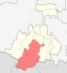
English: Image to indicate North Ossetia districts. Subject as indicated by filename. |
| Date | |
| Source | File:Outline Map of North Ossetia.svg |
| Author | Виктор В |
Licensing edit
.svg&action=edit§ion=2)
| I, the copyright holder of this work, release this work into the public domain. This applies worldwide. In some countries this may not be legally possible; if so: I grant anyone the right to use this work for any purpose, without any conditions, unless such conditions are required by law. |
File history
Click on a date/time to view the file as it appeared at that time.
| Date/Time | Thumbnail | Dimensions | User | Comment | |
|---|---|---|---|---|---|
| current | 14:42, 22 February 2020 | | 1,000 × 1,089 (46 KB) | Takhirgeran Umar (talk | contribs) | уточнение |
| 17:24, 16 August 2010 |  | 1,000 × 1,089 (29 KB) | Виктор В (talk | contribs) | == {{int:filedesc}} == {{Information |Description={{en|1=Image to indicate North Ossetia districts. Subject as indicated by filename.}} |Source=File:Outline Map of North Ossetia.svg |Author=Виктор В |Date=2010-08-16 |P |
You cannot overwrite this file.
File usage on Commons
The following 2 pages use this file:
File usage on other wikis
The following other wikis use this file:
- Usage on az.wikipedia.org
- Usage on ceb.wikipedia.org
- Usage on ce.wikipedia.org
- Алагиран кӀошт
- Абайтикау
- Архон (Къилбаседа ХӀирийчоь)
- Барзикау
- Биз (Къилбаседа ХӀирийчоь)
- Бурон
- Варце
- Верхни Бирагзанг
- Верхни Зарамаг
- Верхни Згид
- Верхни Унал
- Верхни Фиагдон
- Верхни Цей
- Галон (Къилбаседа ХӀирийчоь)
- Горни Карца
- Гусыра
- Дагом
- Дайкау
- Даллагкау
- Дзивгис
- Дзуарикау
- Донисар
- Елгона
- Ецина
- Згил
- Зегтикау
- Зинцар
- Зригатта
- Инджынта
- Кадат
- Калак
- Камсхо
- Кесатикау
- Бад (Къилбаседа ХӀирийчоь)
- Кодахджин
- Красни Ход
- Ксурт
- Курайтта
- Лац
- Лисри
- Луар (Къилбаседа ХӀирийчоь)
- Майрамадаг
- Мизур
- Нар (эвла)
- Нижни Бирагзанг
- Нижни Зарамаг
- Нижни Згид
- Нижни Унал
View more global usage of this file.
.svg)
.svg&oldid=452232243)