File:Location of Podolsk Region (Moscow Oblast) with New Moscow.svg

Size of this PNG preview of this SVG file: 631 × 595 pixels. Other resolutions: 255 × 240 pixels | 509 × 480 pixels | 814 × 768 pixels | 1,086 × 1,024 pixels | 2,172 × 2,048 pixels.
Original file (SVG file, nominally 631 × 595 pixels, file size: 1.11 MB)
Captions
Captions
Add a one-line explanation of what this file represents
Summary
edit_with_New_Moscow.svg&action=edit§ion=1)
| Description |
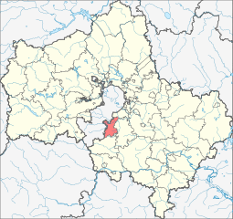
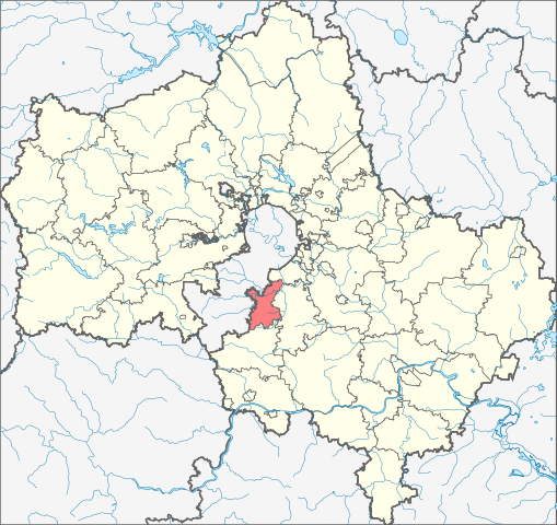
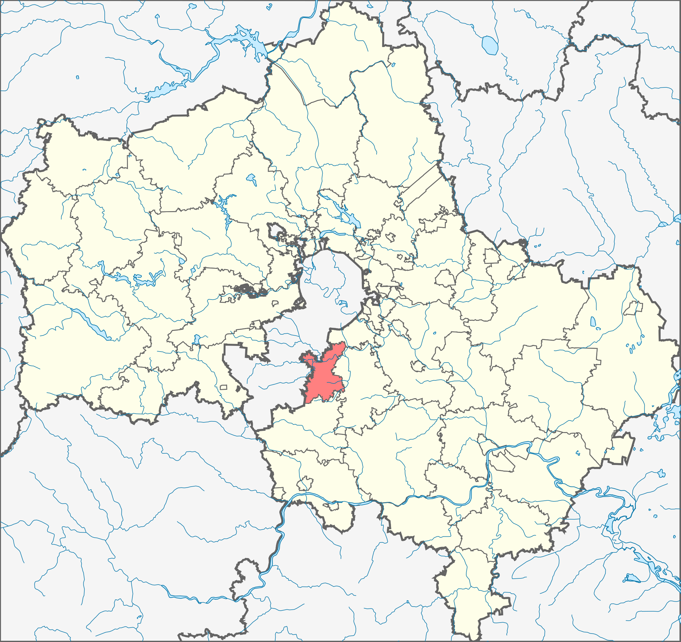
English: Image to indicate Moscow Oblast districts. Subject as indicated by filename.
Русский: Локатор для показа Городского округа Подольск на карте Московской области. |
| Date | (UTC+4) |
| Source |
This file was derived from: Russia Moscow oblast locator map.svg |
| Author |
|
Licensing
edit_with_New_Moscow.svg&action=edit§ion=2)
| I, the copyright holder of this work, release this work into the public domain. This applies worldwide. In some countries this may not be legally possible; if so: I grant anyone the right to use this work for any purpose, without any conditions, unless such conditions are required by law. |
File history
Click on a date/time to view the file as it appeared at that time.
| Date/Time | Thumbnail | Dimensions | User | Comment | |
|---|---|---|---|---|---|
| current | 15:42, 15 July 2015 | | 631 × 595 (1.11 MB) | Nzeemin (talk | contribs) | Городской округ Подольск поглотил Подольский район и городской округ Климовск. |
| 11:58, 4 October 2014 |  | 631 × 595 (1.14 MB) | Новик (talk | contribs) | by analogy with other Moscow Oblast districts | |
| 12:46, 5 October 2013 |  | 2,522 × 2,385 (93 KB) | MUR (talk | contribs) | Renewed from updated Moscow region map. | |
| 13:14, 26 August 2012 |  | 2,522 × 2,385 (104 KB) | Geo.smart (talk | contribs) | {{Information |Description={{en|1=Image to indicate Moscow Oblast districts. Subject as indicated by filename.}} |Source=*Russia_Moscow_oblast_locator_map.svg |Date=2012-08-26 17:13 (UTC+4) |Author=*[[:Fil... |
You cannot overwrite this file.
File usage on Commons
The following page uses this file:
File usage on other wikis
The following other wikis use this file:
- Usage on ceb.wikipedia.org
- Usage on et.wikipedia.org
- Usage on hy.wikipedia.org
- Usage on myv.wikipedia.org
- Usage on ru.wikipedia.org
- Usage on sco.wikipedia.org
- Usage on www.wikidata.org
- Usage on zh-min-nan.wikipedia.org
- Usage on zh.wikipedia.org
_with_New_Moscow.svg&oldid=762411264)