File:Location of Pu'er Prefecture within Yunnan (China).png

Size of this preview: 800 × 591 pixels. Other resolutions: 320 × 236 pixels | 640 × 473 pixels | 880 × 650 pixels.
Original file (880 × 650 pixels, file size: 100 KB, MIME type: image/png)
Captions
Captions
Add a one-line explanation of what this file represents
Summary
edit.png&action=edit§ion=1)
| Description |
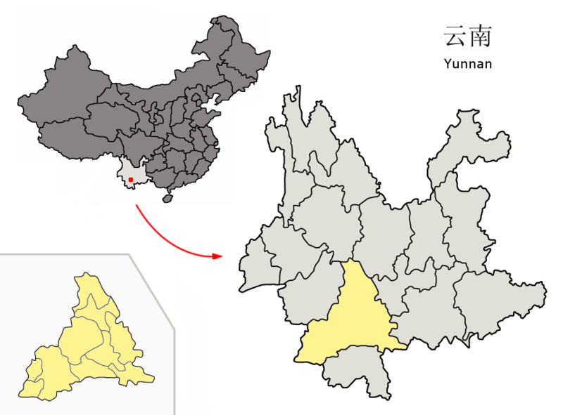
Location of Pu'er Prefecture (yellow) within Yunnan province of China Map drawn in september 2007 using various sources, mainly : |
| Date | |
| Source | Own work |
| Author | Croquant |
Licensing
edit.png&action=edit§ion=2)
I, the copyright holder of this work, hereby publish it under the following license:
This file is licensed under the Creative Commons Attribution 3.0 Unported license.
- You are free:
- to share – to copy, distribute and transmit the work
- to remix – to adapt the work
- Under the following conditions:
- attribution – You must give appropriate credit, provide a link to the license, and indicate if changes were made. You may do so in any reasonable manner, but not in any way that suggests the licensor endorses you or your use.
File history
Click on a date/time to view the file as it appeared at that time.
| Date/Time | Thumbnail | Dimensions | User | Comment | |
|---|---|---|---|---|---|
| current | 09:05, 26 September 2007 | | 880 × 650 (100 KB) | Croquant (talk | contribs) | background cleaned |
| 18:20, 25 September 2007 |  | 880 × 650 (100 KB) | Croquant (talk | contribs) | == Summary == {{Information |Description=Location of Pu'er Prefecture (yellow) within Yunnan province of China Map drawn in september 2007 using various sources, mainly : * [http://sedac.ciesin.org/china/admin/bnd90/t5390.html Yunnan province administrat |
You cannot overwrite this file.
File usage on Commons
The following page uses this file:
File usage on other wikis
The following other wikis use this file:
- Usage on ar.wikipedia.org
- Usage on da.wikipedia.org
- Usage on de.wikipedia.org
- Usage on en.wikivoyage.org
- Usage on et.wikipedia.org
- Usage on eu.wikipedia.org
- Usage on fi.wikipedia.org
- Usage on fr.wikipedia.org
- Pu'er
- Xian autonome hani et yi de Ning'er
- Xian autonome hani de Mojiang
- Xian autonome yi, hani et lahu de Zhenyuan
- Xian autonome hani et yi de Jiangcheng
- Xian autonome dai, lahu et va de Menglian
- Xian autonome lahu de Lancang
- Xian autonome va de Ximeng
- Xian autonome yi de Jingdong
- Xian autonome dai et yi de Jinggu
- District de Simao
- Modèle:Palette Pu'er
- Usage on hak.wikipedia.org
- Usage on it.wikipedia.org
- Usage on ja.wikipedia.org
- Usage on ko.wikipedia.org
- Usage on nl.wikipedia.org
- Usage on nn.wikipedia.org
- Usage on no.wikipedia.org
- Usage on pl.wikipedia.org
- Usage on ru.wikipedia.org
- Usage on sv.wikipedia.org
- Usage on th.wikipedia.org
- Usage on ug.wikipedia.org
- Usage on uk.wikipedia.org
- Usage on vi.wikipedia.org
- Usage on www.wikidata.org
- Usage on zh-classical.wikipedia.org
- Usage on zh-min-nan.wikipedia.org
- Usage on zh-yue.wikipedia.org
- Usage on zh.wikipedia.org
.png&oldid=819919257)