File:Locator map AZO HOR Angustias.svg

Size of this PNG preview of this SVG file: 749 × 599 pixels. Other resolutions: 300 × 240 pixels | 600 × 480 pixels | 960 × 768 pixels | 1,280 × 1,024 pixels | 2,559 × 2,048 pixels | 886 × 709 pixels.
Original file (SVG file, nominally 886 × 709 pixels, file size: 698 KB)
Captions
Captions
Add a one-line explanation of what this file represents
Summary
edit
| Description |
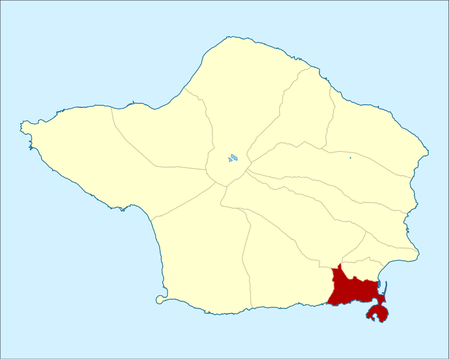
English: Locator map of the civil parish of Angústias, island of Faial (Azores), Portugal Português: Mapa de localização da freguesia das Angústias, ilha do Faial (Açores), Portugal |
| Date | |
| Source | Own work |
| Author | Ruben JC Furtado (Zeorymer) |
Licensing
edit
I, the copyright holder of this work, hereby publish it under the following license:
This file is licensed under the Creative Commons Attribution-Share Alike 3.0 Unported license.
- You are free:
- to share – to copy, distribute and transmit the work
- to remix – to adapt the work
- Under the following conditions:
- attribution – You must give appropriate credit, provide a link to the license, and indicate if changes were made. You may do so in any reasonable manner, but not in any way that suggests the licensor endorses you or your use.
- share alike – If you remix, transform, or build upon the material, you must distribute your contributions under the same or compatible license as the original.
File history
Click on a date/time to view the file as it appeared at that time.
| Date/Time | Thumbnail | Dimensions | User | Comment | |
|---|---|---|---|---|---|
| current | 12:09, 31 August 2011 | | 886 × 709 (698 KB) | Zeorymer (talk | contribs) | Redmension, colour-correction to Wikiproject guidelines |
| 11:47, 30 June 2011 |  | 1,476 × 917 (175 KB) | Zeorymer (talk | contribs) |
You cannot overwrite this file.
File usage on Commons
The following page uses this file:
- File:Locator map FAI HOR Angustia.svg (file redirect)
File usage on other wikis
The following other wikis use this file:
- Usage on en.wikipedia.org