File:Longyeardalen-North-to-South-2022.jpg

Size of this preview: 800 × 533 pixels. Other resolutions: 320 × 213 pixels | 640 × 427 pixels | 1,024 × 683 pixels | 1,280 × 853 pixels | 2,560 × 1,707 pixels | 5,472 × 3,648 pixels.
Original file (5,472 × 3,648 pixels, file size: 4.13 MB, MIME type: image/jpeg)
Captions
Captions
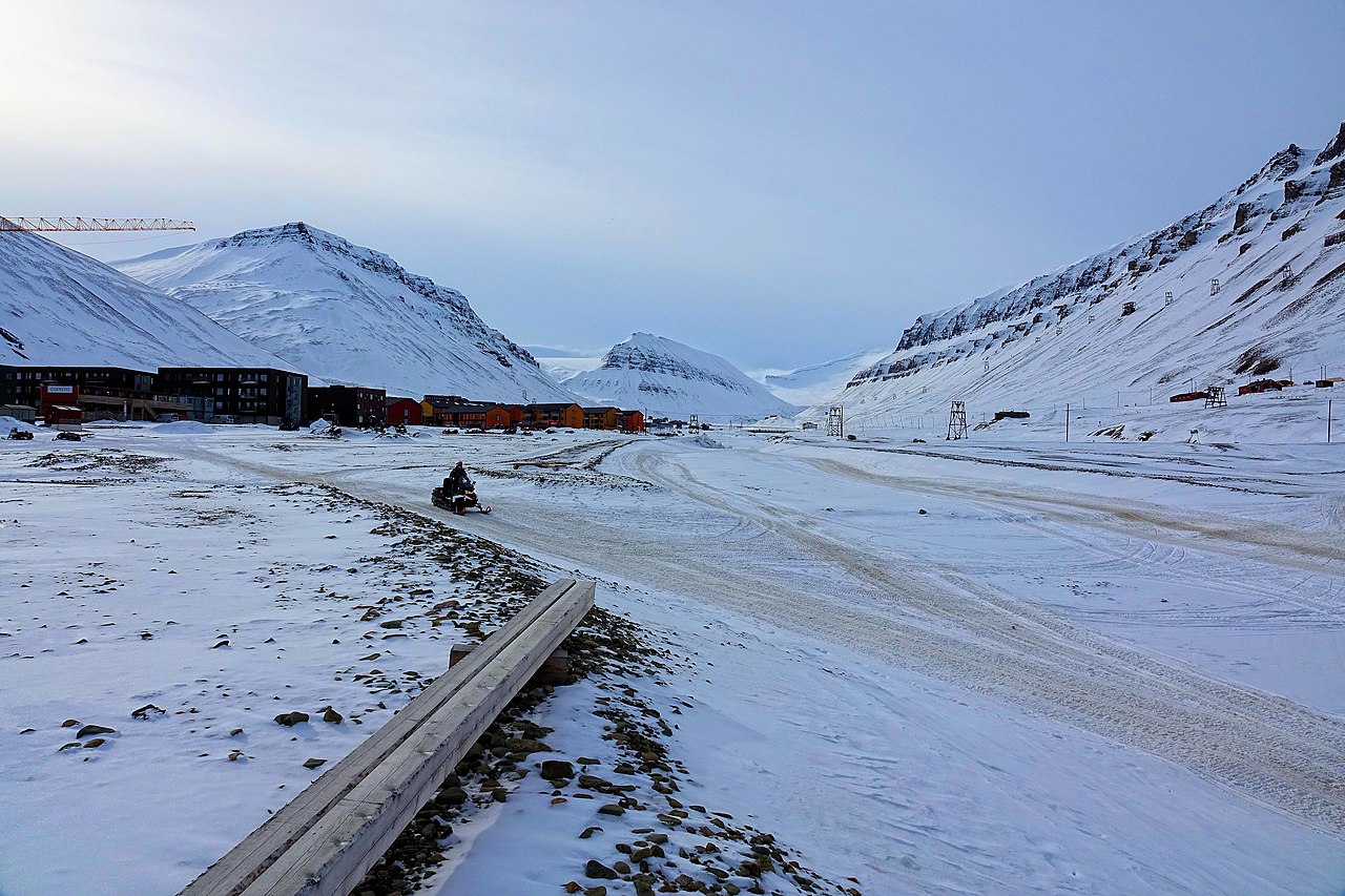
Longyeardalen is the valley leading from the port of Longyearbyen up to the glacier Longyearbreen.
Summary
edit
| Description |
English: The valley Longyeardalen seen from near its northern terminus, with the Elvesletta apartment buildings on the left (eastern) side. The most prominent peak in the background is Sarkofagen. On its right (western) side and beyond lies the glacier Longyearbreen. |
| Date | |
| Source | Own work by uploader, https://bjornfree.com/ |
| Author | Bjørn Christian Tørrissen |
| Camera location | | View this and other nearby images on: OpenStreetMap |
|---|
Licensing
edit
I, the copyright holder of this work, hereby publish it under the following license:
This file is licensed under the Creative Commons Attribution-Share Alike 4.0 International license.
- You are free:
- to share – to copy, distribute and transmit the work
- to remix – to adapt the work
- Under the following conditions:
- attribution – You must give appropriate credit, provide a link to the license, and indicate if changes were made. You may do so in any reasonable manner, but not in any way that suggests the licensor endorses you or your use.
- share alike – If you remix, transform, or build upon the material, you must distribute your contributions under the same or compatible license as the original.
File history
Click on a date/time to view the file as it appeared at that time.
| Date/Time | Thumbnail | Dimensions | User | Comment | |
|---|---|---|---|---|---|
| current | 18:23, 7 January 2023 | | 5,472 × 3,648 (4.13 MB) | Uspn (talk | contribs) | Uploaded own work with UploadWizard |
You cannot overwrite this file.
File usage on Commons
There are no pages that use this file.
File usage on other wikis
The following other wikis use this file:
- Usage on no.wikipedia.org